LiDAR Scanning Technology Powers Projection Mapping for Vivid Sydney 2026
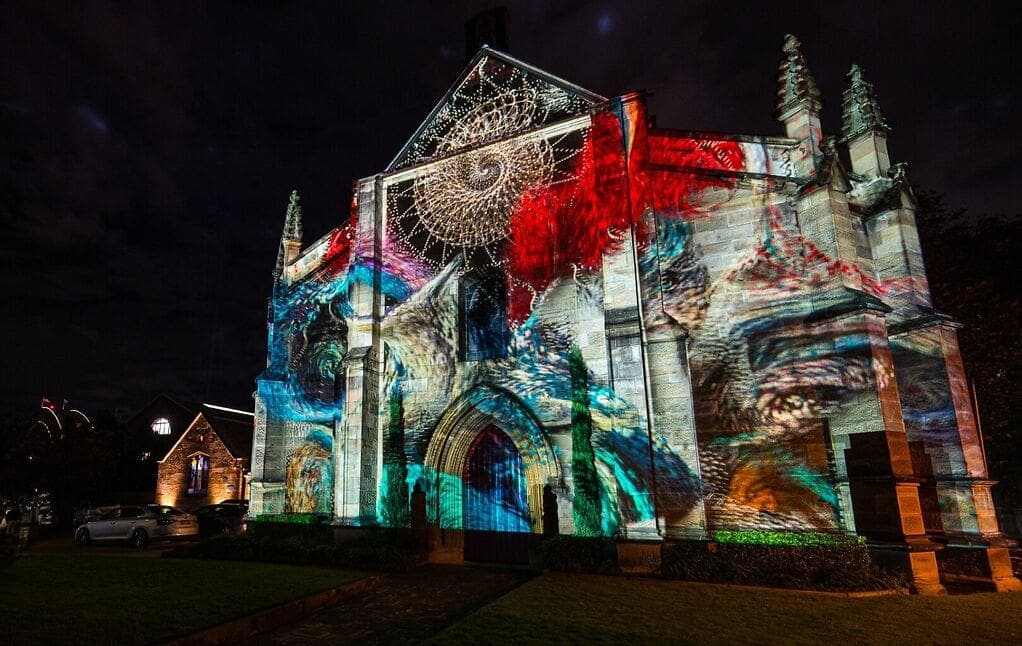
Australian creative technology company TDC (Technical Direction Company) has used LiDAR scanning technology to create high-precision 3D digital replicas of Sydney's Garrison Church and the Argyle Cut ahead of Vivid Sydney 2026. The detailed point-cloud data will support the design, visual testing, and production planning stages of large-scale projection mapping installations at the festival.
Highlights
- TDC (Technical Direction Company) used LiDAR scanning to create high-precision 3D digital replicas of Garrison Church and the Argyle Cut ahead of Vivid Sydney 2026.
- LiDAR technology generates millions of precise coordinate points, capturing complex architectural surfaces and historic stonework textures that traditional survey methods cannot replicate.
- The point-cloud data enables creative teams to simulate projection effects, adjust lighting angles, and refine image boundaries in a virtual environment before physical installation begins.
- Vivid Sydney is the Southern Hemisphere's largest festival of light, music, and creative technology, attracting millions of visitors each year.
- TDC's LiDAR scan results will form the spatial foundation for visual content development across multiple projection mapping installations at the 2026 festival.
LiDAR Scanning Technology Powers Projection Mapping for Vivid Sydney 2026
Australian creative technology company TDC (Technical Direction Company) has once again turned to LiDAR scanning technology to produce high-accuracy, three-dimensional digital models of selected venues ahead of the highly anticipated Vivid Sydney 2026 festival.
LiDAR Scanning: The Unsung Hero Behind Projection Mapping
For this project, TDC rescanned two of Australia's significant historic landmarks — Garrison Church and the Argyle Cut — using LiDAR technology to generate exceptionally precise digital replicas. These high-fidelity 3D point-cloud datasets will serve as essential reference material for creative teams during the design, visual testing, and production planning phases.
Accurate Digital Twins Supporting the Full Production Workflow
For large-scale outdoor projection mapping, the geometric accuracy of a venue is critical. Traditional survey methods struggle to capture the subtle textures of complex architectural surfaces and historic stonework. LiDAR technology, by contrast, can generate millions of precise coordinate points in a short timeframe, producing a complete three-dimensional spatial model.
Creative teams are therefore able to simulate projection effects, adjust lighting angles, and fine-tune image boundaries within a virtual environment before any physical installation work begins — significantly reducing on-site trial-and-error costs and improving overall production efficiency.
Vivid Sydney: The Southern Hemisphere's Premier Creative Technology Festival
Vivid Sydney is the largest festival of light, music, and creative technology in the Southern Hemisphere, attracting millions of visitors each year. Its Creative Technology After Dark program focuses specifically on the intersection of cutting-edge technology and immersive art. The adoption of LiDAR scanning is a clear demonstration of the festival's ongoing commitment to deepening the role of technology in public art.
With preparations for the 2026 edition now fully underway, TDC's LiDAR scan data will form the precise spatial foundation for the visual content development of multiple projection mapping installations — setting the stage for an even more spectacular immersive light-and-image experience for audiences.
原文來源: 查看原文
FAQ
Reviewed and published by the LAETimes editorial desk ·


