昆士蘭大學突破高光譜即時處理技術,無人機影像資料秒級交付成真
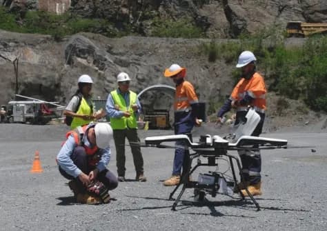
澳洲昆士蘭大學在高光譜影像技術領域達成重大突破,開發出近即時資料獲取系統,將傳統需時數小時甚至數天的影像處理流程大幅縮短。此技術革新使高光譜感測能力得以即時轉化為決策資訊,特別適用於時間敏感的農業管理、環境監測與基建巡檢等應用。隨著無人機搭載高光譜感測器的技術日趨成熟,此一成果預期將成為商業無人機服務的核心競爭力,進而推動整體遙測與空間資訊產業的典範轉移。
澳洲昆士蘭大學研發近即時高光譜影像處理技術,將空中資料從採集到可用的時間大幅縮短,有望為農業、環保、基建巡檢等產業帶來決策效率革命。
重點速覽
- 昆士蘭大學實現高光譜影像近即時資料獲取,縮短傳統數小時至數天的等待時間
- 技術突破使無人機遙測資料處理從後製流程轉向即時分析,開啟產業典範轉移
- 農業監測、環境調查、礦物勘探、基建巡檢等領域獲益,對時效性要求高的應用優勢顯著
- 近即時高光譜處理能力成為商業無人機服務關鍵競爭優勢,加速遙測產業升級
- 技術進展已獲業界認可發表,預計帶動搭載高光譜感測器的無人機應用加速
文章重點
- 昆士蘭大學在高光譜空中影像資料獲取技術的「典範轉移」中扮演關鍵角色。
- 此技術突破可將高光譜影像資料的可用時間從傳統數小時或數天縮短至近乎即時。
- 高光譜影像技術廣泛應用於農業監測、環境調查、礦物勘探與基礎設施巡檢等領域。
- 近即時資料處理能力預計將成為未來商業無人機服務的核心競爭優勢。
高光譜即時處理突破,無人機遙測邁入新紀元
澳洲昆士蘭大學近日宣布在空中影像技術領域取得重大進展,推動了業界所稱的「高光譜資料獲取典範轉移」。此次技術突破的核心意義在於,將傳統需時數小時甚至數天的高光譜影像後製流程,轉變為近乎即時(near-immediate)的資料獲取與分析能力。
技術創新的實質意涵
高光譜影像技術能夠捕捉超越人眼可見範圍的電磁波段資訊,藉由多個微米級波長通道同時採集目標物體的光譜特徵。傳統上,這類資料需經歷複雜的幾何校正、大氣校正、光譜庫匹配等後處理程序,才能轉化為可分析的地物分類圖或健康指數產品,整個流程曠日費時。
昆士蘭大學此番推動的技術創新,透過優化資料傳輸、邊緣運算與雲端處理架構,大幅壓縮了從感測器取像到產出決策資訊的時間差,使使用者能以近即時方式獲得高精度的空間資訊。這項突破對無人機遙測應用的影響深遠。
多領域應用潛力浮現
高光譜無人機影像在農業、環保、礦業與基建等領域的應用前景備受看好。在精準農業領域,農民原本需要等待數天才能得到作物植生指數(NDVI)與水分脅迫指數(NDMI),進而決定灌溉或施肥方案;近即時處理能力則能讓決策週期縮短至小時級,對緊急蟲害防治、肥力調理等時間敏感的農業管理極具價值。
在環境監測與災害應急方面,水質汙染、野火監測、地滑風險評估等應用同樣對時效性有迫切需求。昆士蘭大學的技術突破為這些領域提供了新的解決方案。
產業競爭格局重塑
隨著無人機搭載高光譜感測器(如海康威視等廠商的多光譜模組)的商業應用日益普及,處理能力已成為商業無人機服務廠商的核心競爭力。掌握近即時資料處理技術的業者,將能提供更快的報告交付周期,從而在B2B市場中獲得差異化優勢。
此一成果由Spatial Source等專業媒體報導,已引發業界高度關注,預期將加速推動高光譜無人機遙測的商業化進程,進而帶動整體遙測與空間資訊產業的升級轉型。
對台灣業者的意義
昆士蘭大學的高光譜即時處理技術對台灣無人機產業有直接影響。台灣無人機巡檢與遙測服務業者(如進行農業監測、太陽能板檢測、環境監測的廠商)若能導入此技術,將能將報告交付從數天縮短至數小時,大幅提升客戶滿意度與市場競爭力。此外,台灣廠商若能引進該技術的授權或合作,可開發搭載高光譜感測器的無人機整體解決方案。建議業者密切追蹤昆士蘭大學的後續技術移轉動向,及早評估在地應用與商業化機會,搶佔下一代遙測市場。
常見問題
Newsletter
訂閱低空產業電子報
每日精選低空經濟與無人機產業新聞,直送您的信箱。
本文由 LAETimes 編輯部審核發佈 ·