Drones Aid Search for Missing 4-Year-Old in Aiken County as Operation Covers Over 3,000 Acres
A massive search is underway in Aiken County, South Carolina, for four-year-old Javeayah Harris, missing since the night of June 30. The operation spans more than 3,000 acres and involves drones, helicopters, K9 units, and approximately 200 law enforcement personnel. The search also highlights a stark on-the-ground contradiction in U.S. public safety drone policy, as local deputies and FBI agents operate under entirely different equipment rules due to the federal DJI ban.
Highlights
- Four-year-old Javeayah Harris has been missing in Aiken County, South Carolina since June 30, with the search area exceeding 3,000 acres and approximately 200 law enforcement personnel deployed.
- The Aiken County Sheriff's Office operates 14 drones and 16 licensed pilots, while the FBI on the same scene is banned from using DJI and other Chinese-made drones under the NDAA Covered List.
- More than 80% of U.S. public safety agencies with drone programs use DJI hardware; the federal ban creates a visible equipment split between local and federal personnel working the same operation.
- Thermal imaging drones can locate a missing person in minutes in complete darkness — a DJI Matrice 210 with an XT2 camera found a missing 93-year-old in approximately four minutes in one documented case.
- DJI's global count of confirmed drone-assisted rescues surpassed 1,000 individuals by 2023, counting only cases where a drone directly located or assisted a person.
A four-year-old girl, Javeayah Harris, has been missing from Aiken County, South Carolina since the night of June 30, with the search area now exceeding 3,000 acres. She was last seen at approximately 8:15 p.m. near the intersection of Hillsboro Street and Ridgecrest Road, wearing pink Minnie Mouse pajamas with pink beaded braids in her hair.
Image credit: FOX NEWS
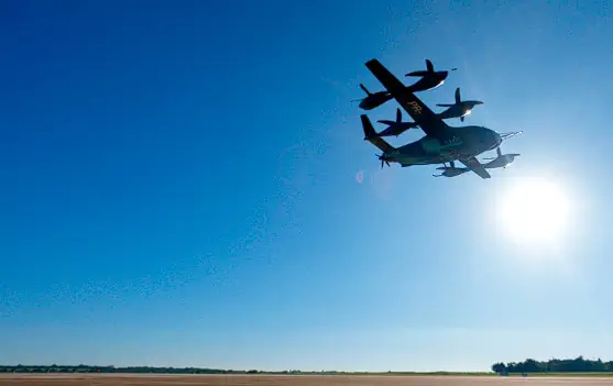
Drones and helicopters are conducting aerial sweeps while K9 search teams and approximately 200 law enforcement officers and first responders work in parallel on the ground.
Multi-Agency Search Covers More Than 3,000 Acres
The Aiken County Sheriff's Office and the South Carolina Law Enforcement Division (SLED) are leading the search, with the FBI also joining the effort. Since June 30, searchers have conducted systematic grid searches on foot across more than 3,000 acres, with aircraft scanning the same terrain from above.
An incident command post was established at Bethel Baptist Church on Tuesday evening, with roughly 200 law enforcement officers and first responders working in rotating shifts over multiple days.
Image credit: FOX NEWS
Javeayah stands approximately 3 feet 6 inches tall and weighs around 40 pounds. She was last seen in pink Minnie Mouse pajamas with beaded braids and may be wearing Crocs. Her parents have corrected early reports describing her as non-verbal or autistic, clarifying that she is a smart, verbal child who may respond if someone calls her name.
Investigators are urging residents to check their own homes, outbuildings, and vehicles, but volunteers are not being accepted at this time to avoid potential evidence contamination. No AMBER Alert has been issued, as the case does not currently meet the qualifying criteria.
Aiken County Sheriff Marty Sawyer expressed the weight of the investigation personally: "As a parent and grandparent of young children, this investigation hits close to home." Anyone with information is asked to call the tip line at 803-502-5200.
Two Agencies, Two Sets of Rules Over the Same Airspace
The Aiken County Sheriff's Office established its own drone program in 2023, operating a fleet of 14 aircraft with 16 licensed pilots. The FBI, also on scene, is subject to federal restrictions that prohibit it from using the most widely adopted law enforcement drones. Two agencies searching the same ground are bound by two entirely different regulatory frameworks.
According to FOX 57, the sheriff's office deploys three sizes of drones: large units for mapping wide-area crime scenes, and smaller units capable of entering structures and outbuildings to clear spaces before officers or K9 teams move in. Local drones can be airborne within minutes, whereas the state helicopter stationed in Columbia takes approximately an hour and a half to reach the county — the very rationale behind building a local drone program.
Image credit: FOX NEWS
The county has not publicly disclosed the drone brands it uses. However, the broader context is significant: more than 80% of U.S. public safety agencies with drone programs rely on DJI hardware, owing to its proven performance and cost advantage over alternatives. Whether Aiken County falls within that majority has not been confirmed.
The FBI operates under a different set of constraints entirely. Under the National Defense Authorization Act (NDAA) and the FCC Covered List — commonly referred to as the "DJI ban" — federal agencies are prohibited from procuring or operating DJI and other Chinese-manufactured drones. The bureau, which once purchased DJI Phantom 4 Pros to train its evidence response teams, is now limited to fiber-optic tethered drones with anti-jamming capabilities and domestically manufactured multirotors.
The result is a visible split on the ground: local deputies fly affordable, high-performance hardware used by the majority of agencies nationwide, while federal agents standing alongside them are legally barred from using the same equipment. This is one of the clearest real-world illustrations of the DJI ban's operational impact — the same contradiction that led Sedgwick County and others to transition their DJI fleets to Skydio last year.
Thermal Drones Narrow the Search Area
Drones equipped with thermal imaging cameras give ground search teams a capability that was previously unavailable: the ability to scan large expanses of brush and tree cover in darkness, flagging heat signatures that foot patrols could easily miss traversing the same terrain.
Thermal imaging can read body heat through haze and vegetation, transforming nighttime searches from educated guesswork into something closer to a systematic grid operation.
Image credit: DJI
The speed advantage is often underestimated. In one well-documented case, a DJI Matrice 210 equipped with an XT2 thermal camera located a missing 93-year-old woman in complete darkness in approximately four minutes — terrain that could have taken a ground team hours to cover.
Image credit: FOX NEWS
Even so, thermal drones do not replace search dogs or personnel. They narrow the search area; K9 handlers and ground teams then converge on the locations the camera flags for confirmation. The layered approach is the point: aircraft rapidly cover wide areas, while personnel reach into every corner the camera cannot.
Confirmed Drone Rescues Have Surpassed 1,000 Worldwide
DJI began tracking confirmed drone-assisted rescues in 2017. By 2023, the global tally had surpassed 1,000 individuals — a significant increase from the more than 500 recorded as of December 2020. The company only counts cases in which a drone directly located or assisted a person, rather than serving as a peripheral element of a broader operation, meaning the true figure is likely higher than the tracked number.
This conservative count is the most honest version of the story. Behind each case is a person found by an aerial camera in time — often at night, often in terrain ground teams could not have reached quickly enough. That is why searches like the one in Aiken County now deploy drones on the first night rather than the third day.
These tools have their limitations. Thermal effectiveness is reduced in daytime heat and under dense tree canopy, and battery life constrains flight endurance. A heat signature is a lead, not a confirmed location — it still requires personnel on the ground to verify. Drones make a search more precise, but they cannot complete it alone.
Editor's Note — DroneXL
I'll be direct. I have children, and reading a story like this is difficult, so I want to be clear about where I stand: I am fully in support of deploying drones in search and rescue because I understand what these aircraft do in the field, and I've watched the number of confirmed rescues climb year after year.
The numbers speak for themselves. More than 1,000 confirmed drone rescues — with DJI counting only direct finds, meaning the real figure is higher.
The logic is straightforward: aerial thermal narrows the search area, K9 units track scent, ground teams confirm. The best search and rescue operations don't choose between these tools — they deploy all of them simultaneously, each one covering the blind spots of the others, and the outcomes are better for it.
What matters most right now, however, is this: Javeayah Harris remains missing in Aiken County, and searchers have put every available tool — including drones — into the air and onto the ground. If you are near the search area and have information, please call the tip line: 803-502-5200.
Image credit: DJI, FOX NEWS
原文來源: 查看原文
FAQ
Newsletter
Subscribe to our Low-Altitude Industry Newsletter
Daily curated news on low-altitude economy and drone industry, delivered to your inbox.
Reviewed and published by the LAETimes editorial desk ·