DJI Drones Support Chinese Scientific Expedition on Everest: 8,861 m Atmospheric Observations and First Centimeter-Level 3D Mapping of Khumbu Glacier Core Zone
DJI held a 'Everest Mission' media briefing in Shenzhen, detailing how its EV50, FC100, and M4E drones supported China's 'Summit Mission' scientific expedition. The EV50 reached a record 8,861 m altitude for atmospheric pollution monitoring; the FC100 transported over 10 tonnes of supplies on the southern slope; and the M4E completed the first centimeter-level 3D mapping of more than 3 km² of the Khumbu Glacier core zone in just 3.5 hours.
Highlights
- The DJI EV50 VTOL drone reached a maximum altitude of 8,861 m during China's Everest 'Summit Mission', completing 32 sorties — 12 dedicated to atmospheric pollution monitoring in the high-altitude troposphere.
- The EV50's all-electric, zero-emission design ensured exhaust gases did not interfere with onboard atmospheric sensing instruments during scientific data collection.
- DJI's FC100 cargo drone, operated with Nepali partner AirLift, transported over 10 tonnes of supplies and cleared nearly 3,000 kg of waste on Everest's southern slope during the 2026 climbing season.
- The FC100 reduced single-trip transport time from several hours on foot to approximately 8 minutes, significantly lowering avalanche and crevasse risk for guides.
- The DJI M4E (Matrice 4E) produced the first centimeter-level 3D map of more than 3 km² of the Khumbu Glacier core zone, including the full Khumbu Icefall, in just 3.5 hours.
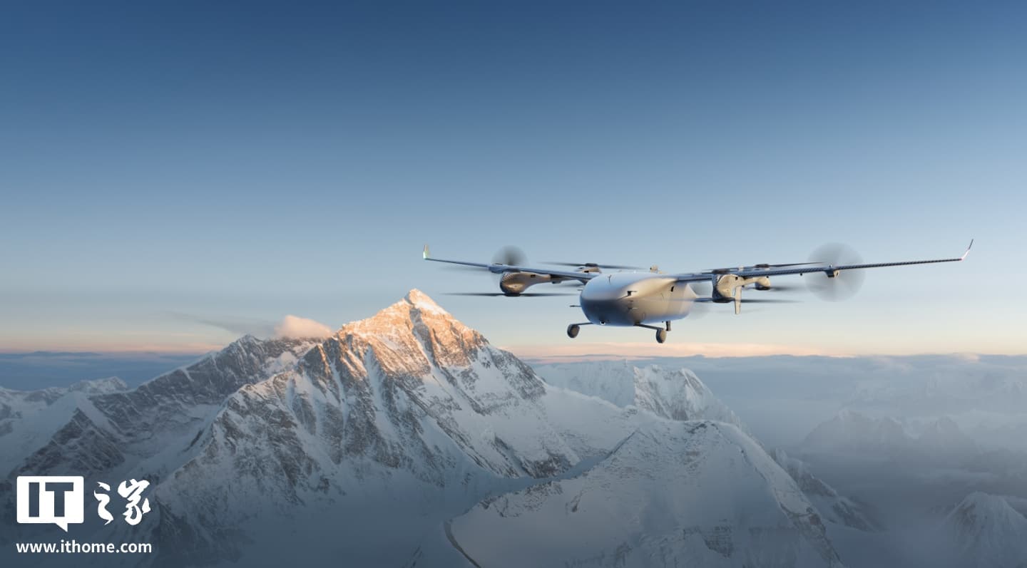
DJI recently hosted an 'Everest Mission' media briefing in Shenzhen, sharing operational details of China's 'Summit Mission' scientific expedition. For the mission, DJI deployed three aircraft: its first vertical take-off and landing (VTOL) cargo drone, the DJI EV50; the cargo drone FC100; and the professional surveying drone M4E. Together, they enabled the expedition team to collect atmospheric data at extreme altitudes and, for the first time, complete centimeter-level three-dimensional mapping of the Khumbu Glacier core zone.
DJI EV50: Breaking the 8,861 m Altitude Barrier
DJI says the EV50 combines multi-rotor vertical take-off and landing with fixed-wing cruising efficiency, allowing it to handle Everest's complex and rapidly changing terrain. Its all-electric, zero-emission propulsion system also ensured that exhaust gases did not compromise the accuracy of onboard atmospheric sensing instruments.
During the Chinese scientific expedition, the EV50 completed a total of 32 sorties, with 12 dedicated to carrying atmospheric data-collection equipment. These flights followed spiral-ascent and back-and-forth flight profiles, ultimately reaching a maximum altitude of 8,861 m — with a maximum continuous climb of 3,730 m — successfully reaching the altitudes required for scientific sampling.
The mission marks the first time China's scientific community has used a drone to conduct detailed observations of atmospheric pollutants in the high-altitude troposphere over Everest, providing crucial support for related research.
FC100: Supply Runs and Eco-Cleanup on the Southern Slope
On Everest's southern slope, DJI partnered with Nepali drone services company AirLift to deploy the FC100 cargo drone and M4E surveying drone as part of an integrated operation covering supply transport, glacier mapping, emergency response, and environmental cleanup.
The FC100 established an aerial corridor between Base Camp and Camp I — carrying supplies upward and waste downward. During the 2026 climbing season, it transported more than 10 tonnes of cargo in total, including approximately 2,300 oxygen cylinders moved in both directions and nearly 3,000 kg of high-altitude waste cleared from the mountain.
Where guides previously had to risk avalanches and crevasses on multi-hour carry trips, the drone now completes the same route in approximately 8 minutes, dramatically improving efficiency while significantly reducing risk to personnel.
M4E: First Centimeter-Level 3D Model of the Khumbu Glacier Core Zone
The DJI M4E (Matrice 4E) surveying drone completed the first-ever centimeter-level 3D mapping of more than 3 km² of the Khumbu Glacier core zone — precisely covering Base Camp, the full length of the Khumbu Icefall, and the terrain above Camp I — in just 3.5 hours.
Armed with high-resolution glacial terrain data, Sherpa icefall doctors can now identify crevasse locations before entering the field, calculate the exact quantities of ladders and ropes required in advance, and minimize exposure time in hazardous zones, making route planning faster and more scientifically grounded.
DJI's comprehensive deployment on Everest demonstrates the broad potential of commercial drone technology in extreme environments — spanning scientific research, cargo logistics, and terrain surveying — and points to new solutions for high-altitude scientific work and mountaineering safety in the future.
原文來源: 查看原文
FAQ
Newsletter
Subscribe to our Low-Altitude Industry Newsletter
Daily curated news on low-altitude economy and drone industry, delivered to your inbox.
Reviewed and published by the LAETimes editorial desk ·


