Gaussian Splatting and LiDAR: A Field Practitioner's Guide
3D Gaussian Splatting (3DGS) is one of the most talked-about technologies in reality capture, but industry discussion often overlooks what practitioners actually need to know. Drawing on 'Splat School' — a ten-lesson field manual designed for the geospatial community — this article breaks down 3DGS fundamentals, ideal use cases, limitations, and why its combination with LiDAR unlocks the greatest practical value for drone mapping and reality capture professionals.
Highlights
- 3D Gaussian Splatting (3DGS) uses millions of trainable 3D Gaussian ellipsoids to represent scenes, achieving real-time or near-real-time rendering speeds that significantly outpace most NeRF implementations.
- 3DGS prioritizes visual fidelity over geometric accuracy and is not suitable as a primary data source for survey-grade measurement tasks.
- Integrating LiDAR point clouds with 3DGS workflows produces fused outputs with both precise geometry and high visual quality, increasing commercial value in BIM, digital twin, and infrastructure inspection applications.
- The ten-lesson Splat School field manual recommends choosing technology based on project goals: LiDAR or photogrammetry for high-precision measurement, 3DGS for immersive visualization and digital twin presentation.
- Large-scale scene processing and incomplete image coverage remain key technical limitations of 3DGS, leading to potential memory bottlenecks and reconstruction artifacts in occluded areas.
3D Gaussian Splatting (3DGS) is currently one of the most widely discussed technologies in the reality capture space. Yet much of the industry conversation skews toward technical hype, glossing over the practical application questions that matter most to working professionals.
This article draws on Splat School — a ten-lesson field manual purpose-built for the geospatial community — to systematically unpack the core concepts behind 3DGS, where it excels, where it falls short, and why integrating it with LiDAR can deliver significantly greater real-world value.
What Is 3D Gaussian Splatting?
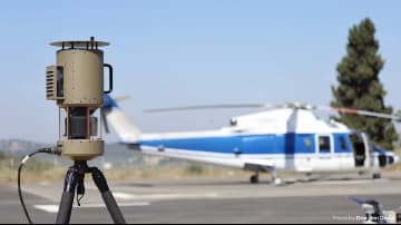
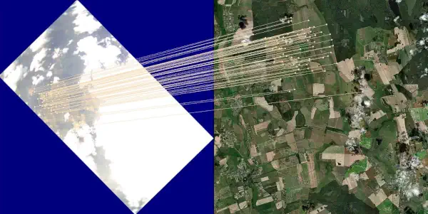
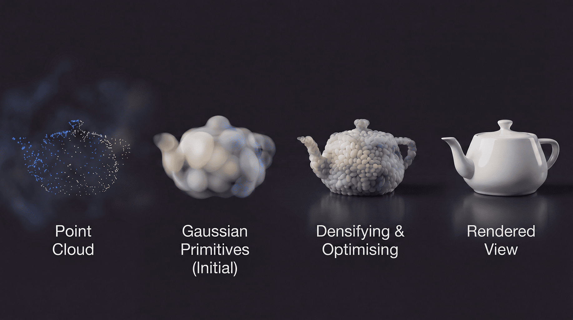
3DGS is a scene representation method rooted in point cloud concepts. It describes the geometry and appearance of a scene using millions of trainable 3D Gaussian ellipsoids. Compared with traditional Neural Radiance Fields (NeRF), 3DGS offers a substantial advantage in rendering speed — achieving real-time or near-real-time visualization — making it highly attractive for field operators who need rapid feedback.
Where 3DGS Excels
- High visual realism: In well-lit environments with rich surface texture, 3DGS produces remarkably lifelike scene reconstructions.
- Fast rendering: Compared with conventional volumetric rendering methods, 3DGS dramatically reduces rendering time, making it well-suited to workflows that require live preview capabilities.
- Manageable hardware requirements: With an appropriate hardware setup, 3DGS training and inference is more efficient than most NeRF implementations.
Challenges and Limitations of 3DGS
Despite its strengths, practitioners will encounter real constraints when deploying 3DGS in production:
- Limited geometric accuracy: 3DGS prioritizes visual fidelity over absolute positional accuracy, meaning it still lags behind traditional photogrammetry or LiDAR for high-precision measurement tasks and should not serve as a primary survey-grade data source.
- Difficulty reconstructing occluded areas: In regions with incomplete image coverage, Gaussian ellipsoid distributions are prone to artifacts and voids.
- Scalability constraints: Processing large-area terrain or complex urban scenes can push memory and compute resources to their limits.
Why the LiDAR–3DGS Combination Matters
For geospatial professionals, integrating LiDAR point clouds into a 3DGS workflow creates a powerful complementary pipeline that addresses the weaknesses of each technology individually:
- LiDAR provides a precise 3D geometric skeleton, ensuring the reliability of spatial measurements.
- 3DGS layers high-quality visual appearance on top of that geometric foundation, enhancing the visual persuasiveness of final deliverables.
- Fused outputs carry higher commercial value in applications such as BIM (Building Information Modeling), digital twins, and infrastructure inspection.
Guidance for Practitioners
The ten lessons of Splat School consistently emphasize that technology selection should be driven by project requirements. Where the primary objective is high-precision measurement, LiDAR or traditional photogrammetry remains the preferred approach. Where the goal is immersive visualization or digital twin presentation, 3DGS is a highly competitive tool. Fused workflows combining both technologies are expected to become the mainstream direction for the geospatial industry going forward.
Content adapted from the Splat School geospatial field series. Refer to the original source for the complete course curriculum.
原文來源: 查看原文
FAQ
Newsletter
Subscribe to our Low-Altitude Industry Newsletter
Daily curated news on low-altitude economy and drone industry, delivered to your inbox.
Reviewed and published by the LAETimes editorial desk ·