Airborne LiDAR Survey Lays the Groundwork for Major Energy Development in Oklahoma
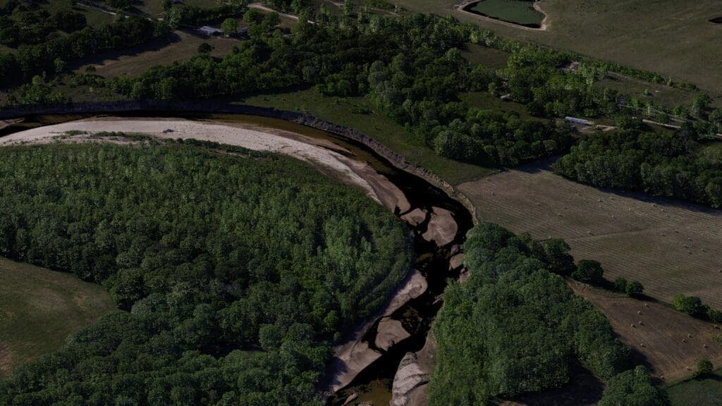
Surveying and engineering firm Blew & Associates has completed an airborne LiDAR survey covering approximately 400 acres near Shawnee, Oklahoma, in support of a large-scale energy development project. The mission was designed to establish a comprehensive existing-conditions dataset for use across the full project lifecycle — from early planning and engineering design through construction and ongoing site management.
Highlights
- Blew & Associates completed an airborne LiDAR survey of approximately 400 acres near Shawnee, Oklahoma, in support of a large-scale energy development project.
- The survey produced an existing-conditions dataset designed for use across the full project lifecycle, from initial planning through construction and site maintenance.
- Airborne LiDAR technology enabled rapid collection of high-density 3D point cloud data, significantly improving efficiency and accuracy over traditional ground-based survey methods.
- Key applications of the LiDAR data include terrain and slope analysis, vegetation mapping, pre-construction baseline establishment, and integration with BIM and GIS platforms.
- Airborne LiDAR surveying is expected to become an increasingly standard pre-construction procedure in North America's growing energy sector.
Airborne LiDAR Survey Lays the Groundwork for Major Energy Development in Oklahoma
Surveying and engineering firm Blew & Associates has completed an airborne LiDAR (Light Detection and Ranging) survey covering approximately 400 acres near Shawnee, Oklahoma, providing critical geospatial data in support of a large-scale energy development project in the region.
Mission Objective: A Dataset Built for the Full Project Lifecycle
The primary goal of the survey was to produce a comprehensive, high-accuracy Existing Conditions Dataset — one designed not only to meet immediate planning needs, but to remain useful throughout the entire project lifecycle. That scope spans initial planning and engineering design, through the construction phase, and into long-term site maintenance and operations.
By leveraging airborne LiDAR technology, the survey team was able to rapidly collect dense, three-dimensional point cloud data across a wide area. Compared with traditional ground-based survey methods, the approach delivered significant improvements in both operational efficiency and terrain data accuracy.
Why Airborne LiDAR Matters for Energy Development
LiDAR technology works by emitting laser pulses and recording the time it takes for those pulses to return, enabling precise reconstruction of surface terrain — including ground profiles beneath vegetation cover. For energy development projects, this type of data offers critical value across several areas:
- Terrain analysis and slope assessment: Supports engineers in planning roads, pipelines, and facility layouts
- Vegetation and obstacle identification: Provides a clear picture of ground cover and helps evaluate development impacts
- Pre- and post-construction baseline: Establishes original terrain conditions for use in construction monitoring and environmental assessment
- BIM/GIS integration: Point cloud data can be directly imported into Building Information Modeling and Geographic Information System platforms
About Blew & Associates
Blew & Associates is a professional surveying and engineering firm with deep roots in the south-central United States, providing high-accuracy geospatial services to the energy, infrastructure, and land development sectors. The successful completion of this Oklahoma energy project further demonstrates the practicality and efficiency of airborne LiDAR technology for large-scale engineering reconnaissance.
As demand for both renewable and conventional energy development continues to grow, airborne LiDAR surveying — as a standard pre-construction site investigation procedure — is expected to play an increasingly important role across North America's energy industry.
原文來源: 查看原文
FAQ
Newsletter
Subscribe to our Low-Altitude Industry Newsletter
Daily curated news on low-altitude economy and drone industry, delivered to your inbox.
Reviewed and published by the LAETimes editorial desk ·