JOUAV Kunlun Unattended Drone System Serves as 'Aerial Sentinel' in Guangdong Emergency Mapping Drill
On June 30, 2026, Guangdong Province held its annual emergency mapping and safety production drill in Shaoguan City during the critical 'Dragon Boat Water' flood season. JOUAV's Kunlun unattended drone system participated throughout, demonstrating fully automated, remotely intelligent capabilities including autonomous takeoff, real-time HD imagery transmission, and integration with a '1+3' air-ground cooperative network to strengthen the province's emergency mapping response.
Highlights
- Guangdong Province conducted its 2026 Annual Emergency Mapping and Safety Production Drill in Shaoguan City on June 30, 2026, during the high-risk Dragon Boat Water flood season.
- JOUAV's Kunlun Unattended Drone System completed a fully automated sequence — including hangar door opening, self-diagnostics, and takeoff — without requiring on-site personnel.
- The system transmitted real-time high-definition imagery from simulated disaster zones, enabling rapid delineation of affected areas and identification of hazard points.
- The Kunlun system is integrated into Guangdong's province-wide '1+3' air-ground cooperative emergency mapping network as a designated core piece of equipment.
- JOUAV stated it will continue iterating its unattended drone hardware and software to support emergency mapping, flood prevention, and geological hazard monitoring frameworks nationwide.
Guangdong Province is currently in the critical defense phase of the 'Dragon Boat Water' season — a period of sustained heavy rainfall that repeatedly triggers flooding and geological disasters, creating a severe and complex emergency management environment. To further strengthen the province's emergency mapping support framework, enhance response efficiency and operational readiness, and reinforce safety production awareness, Guangdong Province held its 2026 Annual Emergency Mapping Support and Safety Production Drill in Shaoguan City on June 30, 2026.
JOUAV's Kunlun Unattended Drone System participated throughout the exercise, demonstrating its fully automated and remotely intelligent capabilities to inject advanced technological capacity into the province-wide emergency mapping support system.
Drone Advance Reconnaissance and the '1+3' Air-Ground Coordination Network
Building Guangdong's Core Emergency Mapping Defense Line
Guangdong Province is actively developing a network of drone hangar stations integrated into a '1+3' province-wide emergency mapping support network. The JOUAV Kunlun Unattended Drone System, designated as a core piece of equipment, has been incorporated into the provincial emergency mapping framework to enable efficient, routine, and comprehensive low-altitude remote sensing data collection, monitoring, and application services across the entire province.
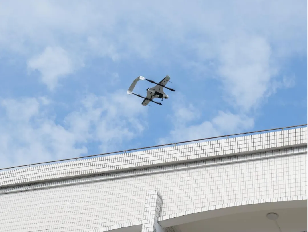
Once the drill command was issued, the Guangdong Provincial Institute of Land Resources Surveying and Mapping — acting as the provincial-level emergency mapping center — rapidly dispatched the Kunlun Unattended Drone System deployed near the simulated disaster zone via the provincial emergency mapping command platform. The system completed a fully automated sequence including hangar door opening, self-diagnostic checks, and takeoff, before the drone was remotely directed to the affected area to capture video footage and conduct disaster reconnaissance.
By eliminating the need for on-site personnel, the hangar units can be pre-positioned in high-risk areas, remaining on standby and ready for immediate deployment at any time.
Real-Time Transmission and Intelligent Recognition
Securing the 'Golden Window' for Emergency Decision-Making
For disaster reconnaissance missions, the JOUAV Kunlun Unattended Drone System leverages its aerial vantage point to transmit high-definition imagery from affected areas in real time. It rapidly performs initial-phase tasks including delineation of disaster zones, precise identification of potential hazard points, environmental surveys of affected areas, and production of remote sensing imagery. This real-time, high-reliability firsthand data provides critical support for downstream emergency response decision-making, establishing a solid 'aerial sentinel' position for the province's emergency mapping operations.
In the face of the sudden flooding and geological hazards brought on by the Dragon Boat Water season, the Kunlun system can be activated swiftly and operate around the clock, conducting continuous dynamic disaster monitoring. It supplies reliable data to rear command centers for assessing disaster conditions and formulating response plans covering emergency rescue, civilian evacuation, and post-disaster recovery — significantly reducing emergency mapping response times and enhancing early warning and rapid response capabilities for natural disasters.
Safeguarding every inch of land through technology; fulfilling every emergency response with responsibility.
JOUAV states it will continue to deepen its expertise in low-altitude intelligent remote sensing technology, iterating and upgrading both the hardware and software capabilities of its unattended drone systems. Through stable and reliable low-altitude intelligent equipment, the company aims to assist local governments in building comprehensive support frameworks for emergency mapping, flood prevention, disaster reduction, and geological hazard monitoring — using technology to protect the lives and property of the public.
(Source: Some content and images courtesy of Guangdong Natural Resources)
原文來源: 查看原文
FAQ
Newsletter
Subscribe to our Low-Altitude Industry Newsletter
Daily curated news on low-altitude economy and drone industry, delivered to your inbox.
Reviewed and published by the LAETimes editorial desk ·


