TUM Drone with Laser System Maps Volcanic Gas Distribution with ~5% Error Rate, Advancing Eruption Prediction
Researchers at the Technical University of Munich (TUM) have successfully deployed an autonomous drone equipped with a laser spectroscopy system over Vulcano island, Sicily, mapping volcanic gas distribution with approximately 5% error. The breakthrough enables continuous, real-time volcanic monitoring without putting volcanologists at risk, and could significantly improve eruption early-warning capabilities worldwide.
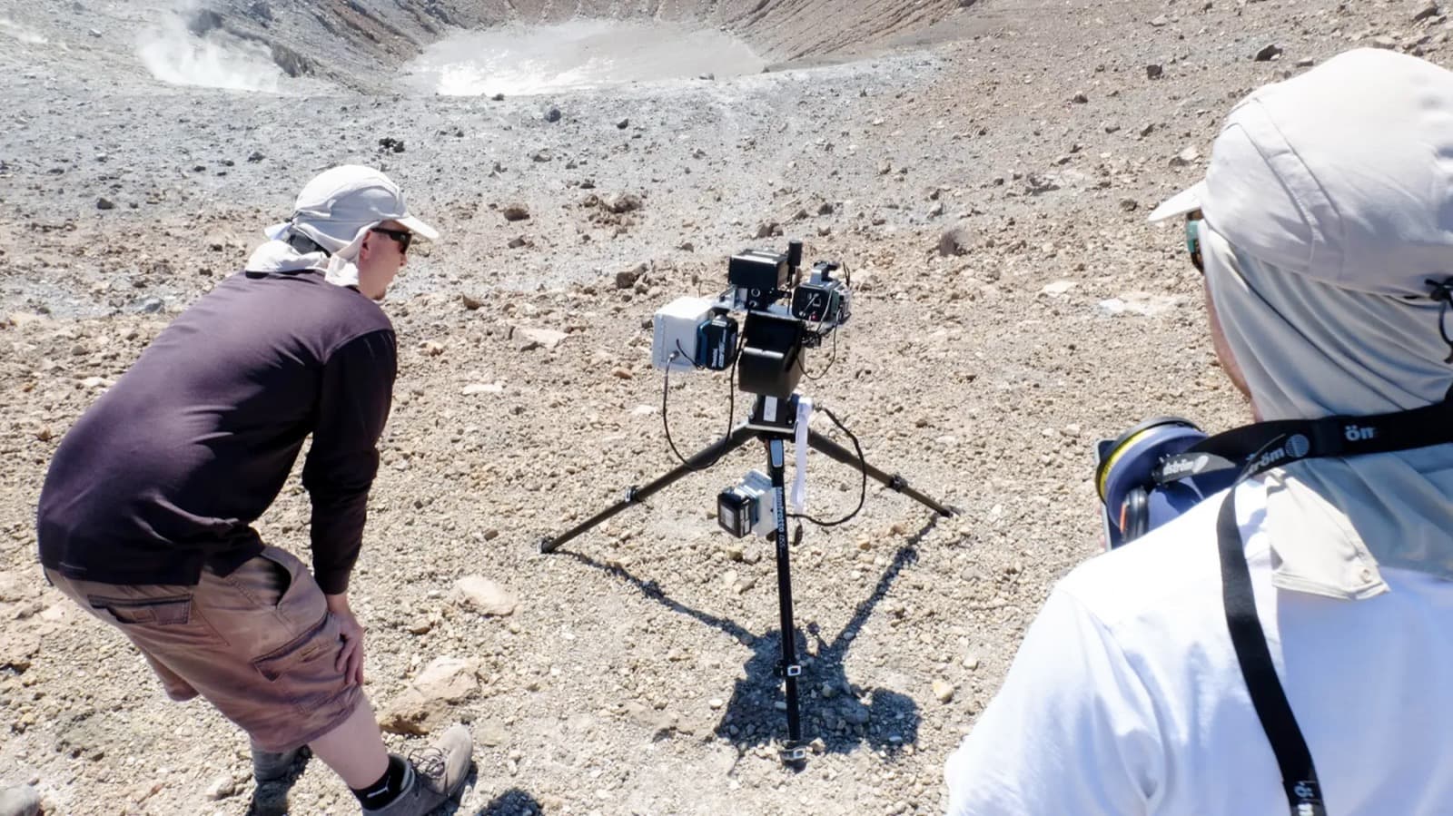
Highlights
- TUM researchers flew an autonomous drone carrying a laser spectroscopy system over Vulcano island, Sicily, mapping volcanic gas distribution with approximately 5% error (95% accuracy).
- The system remotely detects and quantifies toxic fumarolic gases including sulfur dioxide (SO₂) without requiring volcanologists to enter hazardous zones.
- Vulcano, part of Italy's Aeolian Islands, was selected as a real-world testbed due to its heightened fumarolic activity in recent years.
- The drone platform enables continuous, real-time volcanic gas data collection at higher frequency than traditional on-site sampling methods.
- TUM plans to extend the technology to other active volcanoes globally to support early-warning systems and protect nearby populations.
Researchers at the Technical University of Munich (TUM) have completed a landmark mission, deploying an autonomous drone fitted with a laser detection system over the volcanic island of Vulcano, near Sicily, Italy. The survey successfully mapped the spatial distribution of volcanic gases with an error rate of approximately 5%, marking a significant advance in remote volcano monitoring.
Technical Breakthrough: Laser Spectroscopy Replaces On-Site Sampling
At the heart of the mission is the integration of a laser spectroscopy system onto an autonomous drone platform. The system detects and quantifies toxic gases released from volcanic fumaroles — including sulfur dioxide (SO₂) and other volcanic signature gases — entirely via remote sensing. With a measurement accuracy of approximately 95%, the technology substantially improves the reliability of remote volcanic monitoring.
Reducing Human Risk and Improving Eruption Forecasting
Traditional volcanic gas sampling has long required volcanologists to work in close proximity to crater vents, exposing them to toxic gases, extreme heat, and the risk of sudden eruptions. TUM's drone-based laser system can collect critical data continuously and in real time without any personnel entering the hazard zone, providing a safer and higher-frequency data source for volcanic activity forecasting.
Vulcano: A Natural Testbed for Volcanic Monitoring
Situated in the Mediterranean Sea as part of Italy's Aeolian Islands, Vulcano is one of the world's most closely watched volcanically active sites and has seen heightened fumarolic activity in recent years. TUM's research team selected the location for field validation, demonstrating the system's practicality and robustness in a real-world volcanic environment.
Looking Ahead
Beyond advancing volcanology, this research sets a new milestone for drone applications in extreme-environment scientific exploration. The technology is expected to be rolled out to other active volcanoes around the world, contributing to more comprehensive early-warning systems and ultimately helping to protect communities living near volcanic hazards.
原文來源: 查看原文
FAQ
Reviewed and published by the LAETimes editorial desk ·


