NASA Releases Umbra SAR Data Evaluation Reports, Finds Geolocation Accuracy Falls Short of Vendor Specifications
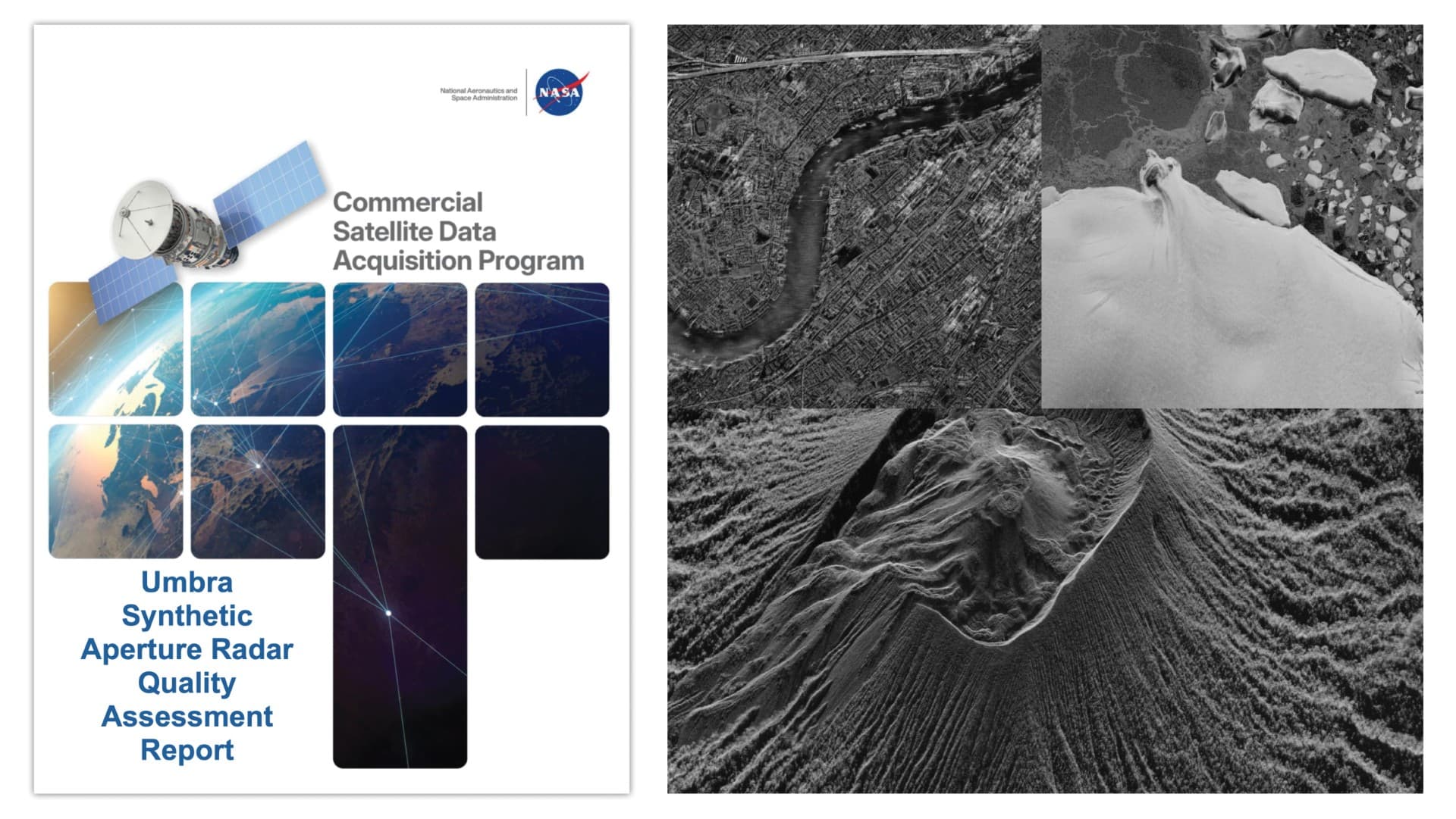
NASA's Commercial Smallsat Data Acquisition (CSDA) program published two evaluation reports in May 2026 assessing Umbra's X-band synthetic aperture radar (SAR) satellite constellation. While the reports praised high spatial resolution and tasking flexibility, they found that geolocation accuracy did not meet vendor specifications and that radiometric performance fell below reference system standards.
Highlights
- NASA's CSDA program published two Umbra X-band SAR evaluation reports in May 2026, covering both principal investigator findings and technical quality assessment.
- Umbra SAR data spatial resolution was confirmed to meet vendor specifications, but geolocation accuracy failed to fully satisfy published performance standards.
- NASA subject matter experts rated Umbra's radiometric performance — measured by absolute accuracy, stability, and sensitivity — as insufficient relative to a well-calibrated reference SAR system.
- Evaluation teams praised Umbra's high spatial resolution, direct tasking capability, imaging flexibility, and Open Data Program as key strengths for Earth science applications.
- Identified shortcomings include geolocation errors, limited software compatibility, incomplete metadata, and missing technical documentation.
NASA Releases Umbra SAR Data Evaluation Reports
NASA's Commercial Smallsat Data Acquisition (CSDA) program has released two new reports providing a comprehensive evaluation of data from Umbra's X-band synthetic aperture radar (SAR) satellite constellation, serving the NASA Earth science research and applications community. The findings are intended to help NASA program managers and end users understand the quality of commercial data available for NASA scientific research.
Both reports — the CSDA Umbra SAR Principal Investigator Evaluation Summary and the CSDA Umbra SAR Quality Assessment Report — were officially published in May 2026.
Principal Investigator Evaluation: Strengths and Shortcomings
The Principal Investigator (PI) Evaluation Summary documents findings from evaluation teams that were granted access to Umbra's historical data archive, as well as the ability to task the Umbra constellation directly for new observations. This tasking capability allowed evaluation teams to test the utility of Umbra data in time-critical workflows and to monitor rapidly changing areas or sudden environmental events, such as harmful algal bloom occurrences.
Overall, the report supports the use of Umbra SAR data for NASA Earth science research and applications, while clearly identifying the strengths and limitations of X-band data.
Key strengths identified:
- Access to a very high spatial resolution X-band SAR satellite constellation
- Taskable with high temporal revisit rates and fast data return
- High imaging flexibility, supporting multiple azimuth and incidence angle configurations
- Company operates an Open Data Program
Key shortcomings identified:
- Geolocation accuracy issues (encompassing both large-scale and small-scale positioning errors)
- Limited software compatibility
- Incomplete metadata
- Absence of certain technical documentation
Quality Assessment Report: Radiometric and Geometric Performance
The Quality Assessment Report documents radiometric and geometric analyses conducted by NASA subject matter experts (SMEs) in accordance with joint NASA–European Space Agency (ESA) evaluation guidelines (ESA-NASA, 2024).
The assessment focused primarily on Level-1 Single Look Complex (SLC) products in Sensor Independent Complex Data (SICD) format, with some Level-2 products also examined for scientific usability. Key findings include:
- Spatial resolution: Data spatial resolution was found to be consistent with Umbra's published specifications.
- Geolocation accuracy: Quality analysis results did not fully meet vendor specifications; SMEs concluded that "the overall geolocation performance of Umbra data did not meet the expected accuracy level."
- Radiometric performance: Evaluated across three metrics — absolute accuracy, stability, and sensitivity — SMEs determined that performance was "overall insufficient relative to a well-calibrated reference SAR system."
About the CSDA Program
NASA's CSDA program was established to identify, evaluate, and acquire data from commercial sources that support NASA Earth science research and applications objectives. NASA's Earth Science Division recognizes the potential of commercial satellite constellations to advance Earth system science and support societally beneficial applications. Commercial data also represents a cost-effective means of supplementing Earth observation datasets from NASA, other U.S. government agencies, and international partners.
The full reports are available for download under the "Evaluation" section of the CSDA official Umbra commercial vendor webpage.
原文來源: 查看原文
FAQ
Newsletter
Subscribe to our Low-Altitude Industry Newsletter
Daily curated news on low-altitude economy and drone industry, delivered to your inbox.
Reviewed and published by the LAETimes editorial desk ·


