Skydio Drone Docks Replace Rooftop Observers as Maryland County Police Department Fully Upgrades DFR System
Montgomery County Police Department in Maryland has announced a full rebuild of its Drone as First Responder (DFR) program, deploying 12 Skydio X10 drone docks across six sites and securing FAA BVLOS authorization to eliminate the need for rooftop visual observers. Since launching in November 2023, the program has completed over 2,000 missions with an average on-scene arrival time of approximately 53 seconds.
Highlights
- Montgomery County Police Department deployed 12 Skydio X10 docks across six sites and obtained FAA BVLOS authorization, eliminating the need for rooftop visual observers on drone missions.
- Since launching in November 2023, the DFR program has completed 2,064 missions, with drones arriving on scene before officers in 1,439 cases at an average response time of approximately 53 seconds.
- Drones have helped locate more than 450 people, including missing persons and individuals experiencing mental health crises, since the program began.
- The Skydio X10 dock can launch a drone in about 20 seconds, operates in temperatures from -20°C to 50°C, and supports a control link range of up to 7.5 miles (12 km).
- Montgomery County publishes a public dashboard logging every drone mission by location and reason, with no facial recognition software or microphones on any aircraft.
Skydio Drone Docks Replace Rooftop Observers as Maryland County Police Department Fully Upgrades DFR System
Montgomery County, Maryland has officially retired its rooftop observers. The county's police department announced on July 6 that it is fully rebuilding its Drone as First Responder (DFR) program using Skydio X10 drones paired with dock systems deployed across six sites, after securing Federal Aviation Administration (FAA) authorization to conduct beyond visual line of sight (BVLOS) flights without human observers.
Montgomery County was among the earliest agencies within the Major Cities Chiefs Association to launch a DFR program, doing so in 2023, and DroneXL has followed the program's development closely.
What Has Changed in Montgomery County
The department has replaced its existing drone fleet with Skydio dock systems, placing two docks at each of its six sites. This configuration means that when the first drone returns from a call, a second aircraft can launch immediately to handle the next emergency without any wait time.
With two docks per site and six sites countywide, the department now has 12 docks in total, enabling simultaneous response to two incidents within the same area. The previous model required a human observer to stand on a rooftop and visually monitor each flight; the new system eliminates that requirement entirely.
Through coordination with the FAA and other federal partners, Montgomery County has obtained BVLOS authorization from each dock location, significantly extending the operational range and responsiveness of each drone while reducing personnel costs. Officers who previously had to staff rooftop observation posts can now remain on the ground for other duties.
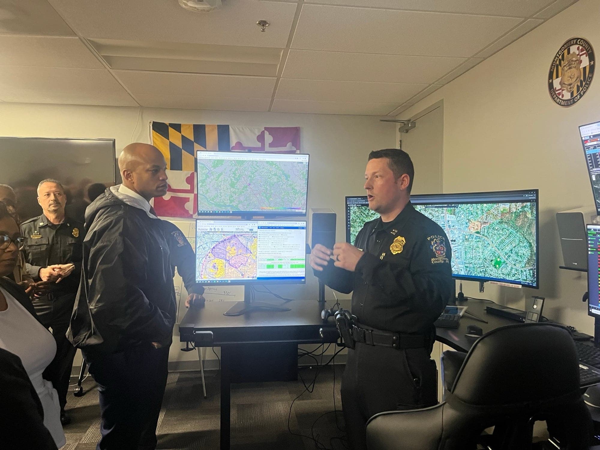
All flights are monitored by the county's Joint Operations Center at Public Safety Headquarters, where a single team manages all six sites through one unified screen interface. Silver Spring downtown, White Oak, Gaithersburg, Montgomery Village, and Germantown are already operational; Wheaton and Bethesda are expected to go live this summer.
The Numbers Behind the Expansion
This expansion is grounded in demonstrated results. Since launching in November 2023, the program has completed more than 2,000 missions — specifically 2,064 service calls — with drones arriving on scene before officers in 1,439 of those instances.
The average drone arrival time is approximately 53 seconds. That figure proved decisive in persuading department leadership, as that narrow window determines whether a critical situation deteriorates or receives immediate attention. Across all missions, drones have helped locate more than 450 people, many of them missing persons or individuals experiencing mental health crises.
The program originated as a concept in 2022. The department's command-level working group traveled to California in 2023 to observe DFR operations firsthand in Chula Vista, Beverly Hills, and Santa Monica before committing to adoption. Community outreach meetings and county council briefings followed that summer, building public support in advance. The current expansion is a product of that careful groundwork and was recognized with a 2024 National Association of Counties award.
Skydio Hardware Breakdown
Each site is equipped with Skydio X10 drones housed in weatherproof "Dock for X10" base stations. The dock can launch a drone in approximately 20 seconds and supports continuous flight in moderate rain and winds up to 28 mph (45 km/h).
The dock features independent heating and cooling systems that keep the drone mission-ready across an operating range of -20°C to 50°C (-4°F to 122°F) — a critical capability for Montgomery County's cold winters and hot, humid summers.
The X10 carries a 64-megapixel wide-angle camera and a 48-megapixel zoom lens for capturing clear detail at distance. Nighttime operations rely on a Teledyne FLIR Boson+ radiometric thermal imaging sensor capable of detecting heat sources through smoke and darkness. Skydio specifies a control link range of up to 7.5 miles (12 km), providing substantial coverage from a fixed dock location.
The dock is the enabler of observer-free legal flight. It incorporates an ADS-B receiver to monitor nearby manned aircraft traffic, onboard weather sensors for pre-flight checks, and automated contingency capabilities such as pre-designated emergency landing zones. This hardware safety architecture formed the technical basis of Montgomery County's FAA waiver application and is a key reason Skydio continues to win these contracts even at a higher unit cost than some (heavily regulated) competitors.
Dock-based DFR represents the second wave of this technology. The first wave still required a certified pilot on a rooftop supervising every launch; the dock era replaces that with a weatherproof enclosure on a pole and an FAA waiver, and police departments across the country are following Montgomery County's lead.
One clarification is worth making on the term "autonomous flight." These drones do take off from their docks on their own and navigate to a scene while autonomously avoiding obstacles. However, a licensed remote pilot at the operations center monitors every flight and can take manual control whenever human judgment is required. Autonomous launch — yes. Autonomous decision-making — no.
Privacy Protections Through Policy and a Public Dashboard
Montgomery County placed significant emphasis on privacy safeguards in its announcement, and the specifics hold up to scrutiny. The drones carry no facial recognition software and no microphones. Cameras are oriented toward the horizon while flying to and from incident scenes. Every dispatch is logged and publicly accessible on a dashboard that any resident can view.
The dashboard details the location and reason for each flight. This is a level of transparency that many departments promise but few deliver, and Montgomery County deserves straightforward credit for it. Several other agencies have faced hostile community meetings over the same technology; Montgomery County chose disclosure over evasion and built public trust before it needed it.
That said, "camera pointed at the horizon" remains a policy, not a hardware lock. Its effectiveness depends on institutional discipline and ongoing public oversight. The public dashboard converts that commitment into an auditable record — which is precisely what makes it more meaningful than a press release.
Analysis
Setting aside the press release language, the most consequential element of this upgrade is not the hardware — it is the BVLOS waiver that made rooftop observers obsolete. Fewer personnel tied up watching the sky means each dock delivers more coverage hours. That is the real headline.
What actually built public trust is transparency, and Montgomery County did not cut corners there. The dashboard is publicly accessible, cameras face the horizon en route to incidents, and no facial recognition or audio recording capability exists on the aircraft. These are concrete measures, and they represent considerably more effort than most law enforcement agencies are willing to make.
Image credits: Montgomery County Police Department, Port St. Lucie Police Department, Skydio
原文來源: 查看原文
FAQ
Newsletter
Subscribe to our Low-Altitude Industry Newsletter
Daily curated news on low-altitude economy and drone industry, delivered to your inbox.
Reviewed and published by the LAETimes editorial desk ·


