Xcalibur Smart Mapping and Dronamics Partner to Advance Natural Resource Exploration Technology
Aerial geophysical survey specialist Xcalibur Smart Mapping and long-range fixed-wing drone company Dronamics have announced a formal partnership to co-develop drone-based aerial geophysical exploration solutions. The collaboration aims to improve efficiency, reduce costs, and enhance safety in natural resource exploration across mining, oil and gas, and groundwater survey sectors.
Highlights
- Xcalibur Smart Mapping and Dronamics have formally partnered to co-develop drone-based aerial geophysical survey systems for natural resource exploration.
- The collaboration targets industries including mining, oil and gas, and groundwater resource assessment, aiming to replace costly crewed aircraft with drone solutions.
- Dronamics contributes long-range fixed-wing drone platforms known for high payload capacity, low cost, and extended range, while Xcalibur brings deep aerial geophysical survey expertise.
- No specific timeline or commercialization plan for the joint solution has been announced by either company.
Aerial geophysical survey specialist Xcalibur Smart Mapping and long-range fixed-wing drone cargo company Dronamics have announced a formal partnership to jointly develop drone-based aerial geophysical exploration solutions, with the goal of driving technological innovation in the natural resource exploration sector.
Background and Objectives
The collaboration combines Xcalibur Smart Mapping's deep expertise in aerial geophysical surveying with Dronamics' extensive experience developing long-range fixed-wing drone platforms. By integrating their respective core competencies, the two companies aim to build a drone-based geophysical survey system capable of significantly improving exploration efficiency while reducing operational costs.
Traditional aerial geophysical exploration has long relied on crewed fixed-wing aircraft or helicopters, which are not only expensive to operate but also present elevated safety risks when working in remote or complex terrain. The introduction of drone-based solutions is expected to address these pain points, offering more flexible and safer exploration options for industries including mining, oil and gas, and groundwater resource assessment.
About the Partners
Xcalibur Smart Mapping is a global leader in aerial geophysical surveying and smart mapping, providing high-precision airborne data acquisition and analysis services for mining, environmental monitoring, and infrastructure development.
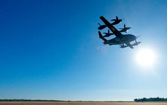
Dronamics specializes in the development of long-range fixed-wing drones, with platforms characterized by high payload capacity, low operating costs, and extended range. The company has established a strong reputation in logistics and special-mission applications.
Industry Significance
This partnership signals the continued penetration of drone technology into the traditional geophysical exploration market. As drone sensor technology and platform performance continue to advance, industry observers expect unmanned systems to play an increasingly prominent role in natural resource exploration, delivering more cost-effective operational models for the sectors involved.
Neither company has disclosed a specific timeline or commercialization roadmap for the collaboration. Further developments are expected to be announced as the partnership progresses.
原文來源: 查看原文
FAQ
Newsletter
Subscribe to our Low-Altitude Industry Newsletter
Daily curated news on low-altitude economy and drone industry, delivered to your inbox.
Reviewed and published by the LAETimes editorial desk ·