Seeing the Whole Picture Before They Step In: How DJI M4E and DJI Terra Map the Khumbu Icefall to Protect the Icefall Doctors
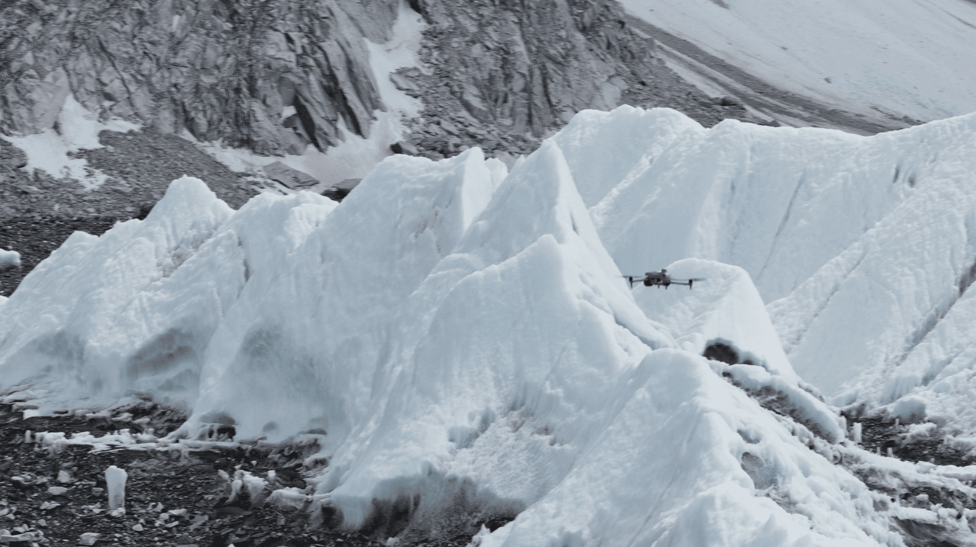
Every climbing season, a team of 8–10 Sherpa guides known as the 'Icefall Doctors' enter the Khumbu Icefall ahead of all other climbers to fix ropes and ladders at altitudes of 5,500–6,000 m. The glacier moves roughly one metre per day, creating unpredictable hazards. The DJI Matrice 4E (M4E) drone paired with DJI Terra mapping software now gives the team accurate, up-to-date terrain models before they set foot in the danger zone.
Highlights
- A team of 8–10 Sherpa 'Icefall Doctors' enters the Khumbu Icefall each season at 5,500–6,000 m to fix ropes and ladders before any other climbers ascend Everest.
- The Khumbu Icefall glacier moves approximately one metre per day, continuously creating unpredictable new hazards such as crevasses and ice collapses.
- The DJI Matrice 4E (M4E) drone operates reliably in high-altitude, low-pressure, and low-temperature conditions to rapidly capture large-area terrain imagery.
- DJI Terra software converts M4E imagery into 2D orthomosaic maps and 3D point-cloud models, enabling teams to compare terrain changes across dates and pre-plan routes.
- The M4E and DJI Terra combination gives the Icefall Doctors actionable aerial intelligence before entering the danger zone, significantly improving route-planning safety.
Every year, before a single climber sets foot on Everest, a team of 8–10 Sherpa guides enters the Khumbu Icefall first. Working at 5,500–6,000 metres above sea level, they breathe thin air while facing constant threats from ice collapses, avalanches, and sub-zero temperatures. Their mission: fix ladders and ropes to open the route for every climber who follows. On Everest, they are known as the Icefall Doctors.
One of the World's Most Unpredictable Terrains
The Khumbu Icefall connects Base Camp (5,364 m) to Camp 1 (6,500 m) and serves as the only passage to the summit — and one of the most unpredictable environments on Earth. The glacier moves approximately one metre per day, constantly reshaping itself and generating new hazards without warning.
For the Icefall Doctors, understanding the icefall's current condition and direction of movement is not an academic exercise — it is the difference between a safe route and a fatal one.
DJI M4E: An Aerial Eye in Extreme Conditions
The DJI Matrice 4E (M4E) is engineered for professional mapping and inspection operations. Equipped with high-resolution sensors and strong wind-resistance capabilities, it can operate reliably in the high-altitude, low-pressure conditions of the Khumbu Icefall. In terrain that changes by the hour, the M4E can rapidly collect large-area imagery, giving ground teams the latest topographic data in the shortest possible time.
DJI Terra: Turning Imagery Into Actionable Maps
DJI Terra is DJI's professional mapping software, capable of automatically processing drone imagery into high-accuracy 2D orthomosaic maps and 3D point-cloud models. For the Khumbu Icefall mission, DJI Terra enables the Icefall Doctors and their support team to:
- Track terrain changes over time: By overlaying models from different dates, teams can clearly identify the direction of glacier movement and the formation of new crevasses.
- Plan routes in advance: Before entering the hazard zone, teams can simulate and evaluate the safest possible path on a computer.
- Keep information current: New maps are generated quickly after each flight, ensuring data always reflects the latest terrain conditions.
Technology Protecting the Protectors
Operating conditions in the Khumbu Icefall are a severe test for any equipment — low oxygen, extreme cold, strong winds, and dramatic terrain relief. The combination of the DJI M4E and DJI Terra gives the Icefall Doctors an intelligence advantage that was previously unimaginable: before stepping into the danger zone, they can already survey the full scope of the challenge ahead from an aerial perspective.
This is not only a breakthrough in applied technology — it is the most tangible form of technical support for the unsung heroes who silently safeguard every climber on the world's highest mountain.
原文來源: 查看原文
FAQ
Reviewed and published by the LAETimes editorial desk ·


