MyZone Manager: Droniq's Urban Drone Management Platform Built for Local Governments
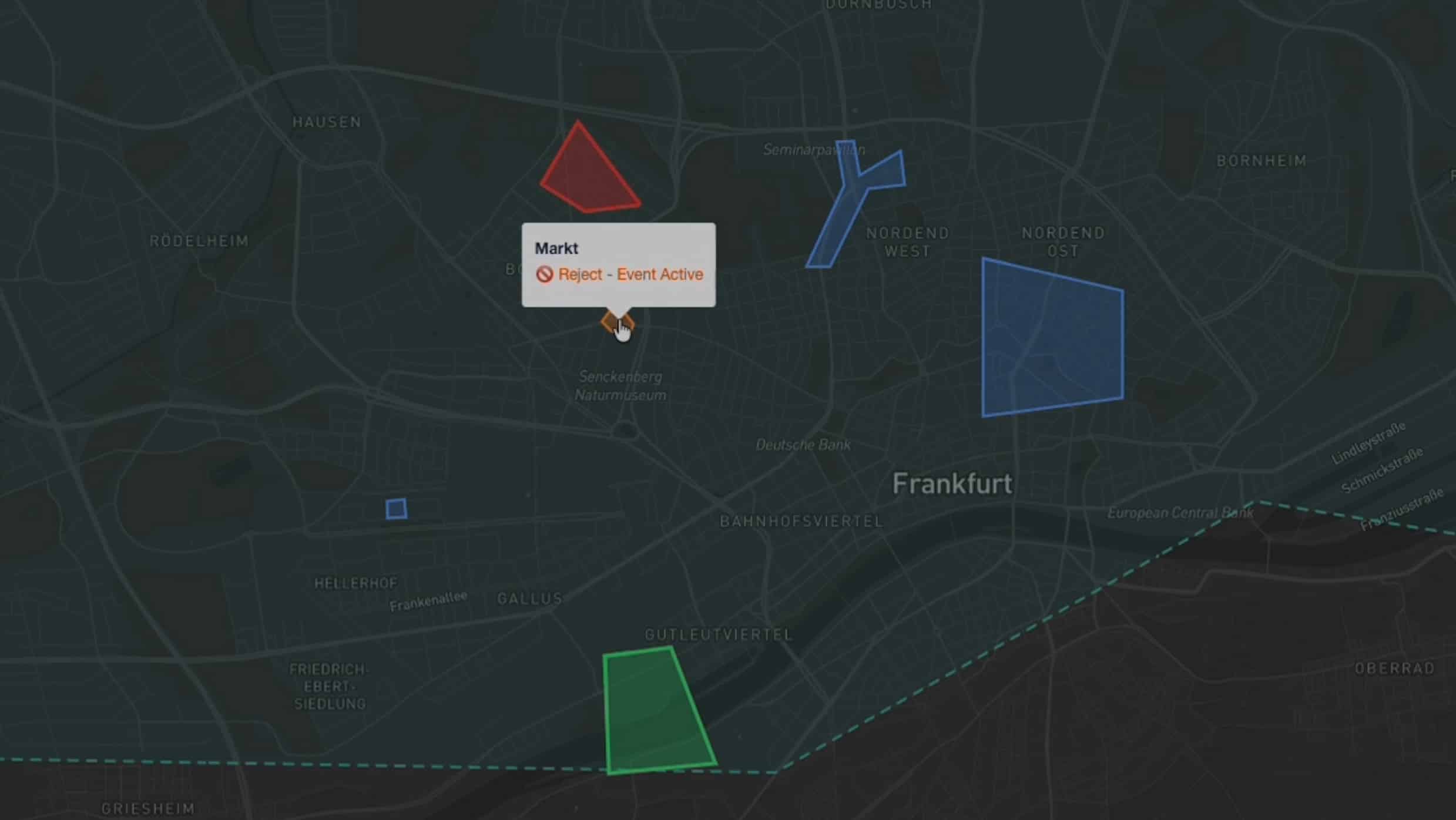
German drone technology company Droniq has launched MyZone Manager, a digital drone management platform designed specifically for municipal and local governments. The platform enables online flight permit applications, authorization workflows, centralized record-keeping, and inter-agency data sharing. An optional add-on module, MyZone Detection, identifies unregistered drone flights within designated zones, providing cities with a comprehensive airspace situational picture to enhance urban airspace safety and accountability.
Highlights
- German drone technology company Droniq launched MyZone Manager, the first digital drone management platform purpose-built for municipal and local government authorities.
- MyZone Manager enables online drone flight permit applications, designated pilot accountability, centralized auditable records, and real-time data sharing with law enforcement agencies.
- An optional add-on module, MyZone Detection, identifies unauthorized or unregistered drone flights within designated zones and automatically generates alerts when restricted airspace is breached.
- The combined MyZone Manager and MyZone Detection solution provides cities with comprehensive urban airspace situational awareness, covering both authorized and unregistered drone activity.
- Droniq's platform targets key urban management pain points including fragmented application processes, unclear authority responsibilities, and undetected unauthorized flights over public spaces.
Drones Enter the Urban Airspace
Municipalities and local governments are increasingly feeling the impact: drones have become part of everyday urban life, widely used for building inspections, construction monitoring, and media production — and their presence continues to grow.
As applications expand, so does the pressure on local authorities and policymakers:
- Who is operating in the airspace above the city?
- Which flights have been authorized?
- How can flight safety in urban areas be ensured?
The core challenge is clear: a lack of transparency and effective oversight mechanisms.
The Current Reality: No Complete Picture of Urban Airspace
Many processes related to drone operations remain fragmented:
- Flight applications are handled in a scattered manner, with no unified portal
- Responsibilities among authorities are poorly defined
- Unauthorized or unregistered flights often go undetected
For cities, the fundamental problem is this: local governments bear responsibility for safety and order in public spaces, yet often lack comprehensive situational awareness of their own airspace.
This gap becomes especially apparent during large-scale public events, in sensitive restricted zones, and when responding to complaints from residents.
The Solution: MyZone Manager Brings Transparency to Drone Operations
MyZone Manager is the first digital drone management tool designed specifically for local government authorities, enabling cities to systematically oversee drone flight activity.
Key features include:
- Digital applications and authorizations: Online submission and approval of drone flight permits
- Clear accountability: Every flight is linked to a registered, responsible pilot
- Centralized record-keeping: Flight data is traceable and auditable
- Inter-agency information sharing: Relevant data can be shared in real time with law enforcement, police, and other agencies
Through these capabilities, MyZone Manager establishes a transparent system covering all known and approved flights, streamlining administrative workflows and strengthening cross-agency cooperation.
Optional Add-On: MyZone Detection
One critical challenge remains — not all drone flights are filed in advance.
MyZone Detection, an optional add-on module, was developed precisely to address this gap. The solution detects drones operating within designated areas, cross-references their flight paths against predefined restricted zones, and automatically triggers alerts when necessary.
The key value proposition: unregistered flights are integrated into the overall airspace situational picture, eliminating blind spots in urban airspace management.
From Full Awareness to Effective Response
The combination of MyZone Manager and MyZone Detection makes comprehensive urban airspace situational awareness possible for the first time:
- Approved flights are clearly documented and traceable
- Unknown aerial activity can be identified
- Relevant agencies can respond based on complete, reliable information
For local governments and policymakers, this translates into:
- Better-informed decision-making
- Greater real-time response capability
- Increased transparency and accountability to citizens
This capability is particularly critical during large public gatherings, around sensitive infrastructure, and as drone activity in urban areas continues to rise.
Conclusion: Digital Management as the Foundation for Safer Cities
Drones will continue to shape urban environments for the long term, creating an urgent need for clear processes, high transparency, and digital support tools.
With MyZone Manager and the optional MyZone Detection module, local governments now have, for the first time, the ability to manage urban airspace in an organized, traceable, and accountable manner.
For government and administrative bodies, the platform provides a foundational infrastructure to:
- Ensure airspace safety
- Maintain clear management accountability
- Proactively plan for the growing use of urban airspace
Interested in learning more? Schedule a consultation with Droniq's sales team today.
原文來源: 查看原文
FAQ
Newsletter
Subscribe to our Low-Altitude Industry Newsletter
Daily curated news on low-altitude economy and drone industry, delivered to your inbox.
Reviewed and published by the LAETimes editorial desk ·


