Teledyne FLIR IIS: The Critical Camera Embedded in the System Stack
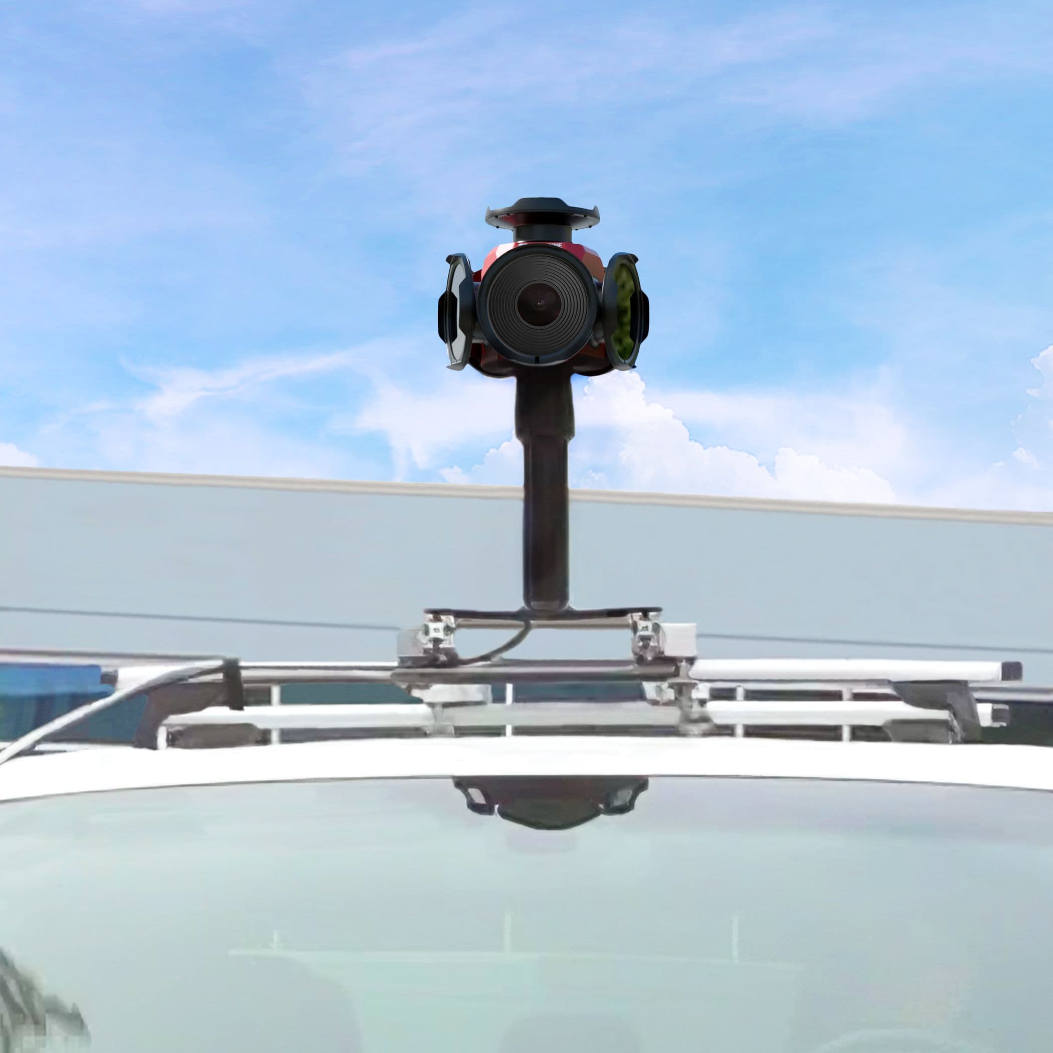
At Geo Week 2026, Teledyne FLIR IIS Product Management Director Mike Lee described his company's mission: providing the visual sensing layer that makes mobile mapping systems work. The Ladybug camera series, with nearly 30 years of history, now reaches 72 megapixels with ±2 mm positional accuracy at 10 metres, serving vehicle-based mapping, autonomous vehicles, and infrastructure planning.
Highlights
- Teledyne FLIR IIS 的 Ladybug 系列相機已有近三十年歷史,首款多感測器相機於 2002 年問世,曾參與 Google Street View 早期開發。
- Ladybug6 達 72 百萬像素、IP67 防護等級、工作溫度至 -30°C,10 公尺處空間精度為 ±2 公釐。
- 系統採用確定性時序與 PTP 精確時間協定,確保相機與 GNSS 及其他感測器在移動測繪中精確同步。
- 產品生命週期長達七至十年,OEM 客戶提前 12–24 個月獲得變更通知,支援大規模車隊部署(如 TomTom 測繪車隊)。
- Teledyne FLIR IIS 明確定位為純感測層供應商,不涉足生成式 AI,專注提供高精度原始影像供下游合作夥伴進行 AI 分析與資產萃取。
Teledyne FLIR IIS: The Critical Camera Embedded in the System Stack
When Mike Lee, Director of Product Management for Teledyne FLIR IIS's spherical imaging business, sat down with xyHt at Geo Week 2026, he was not pitching a new workflow platform or a digital twin ecosystem. He was describing a company whose core mission is to provide the visual sensing layer that keeps other companies' systems running — and to argue that getting that layer right matters more than anything stacked on top of it.
"We're embedded in a lot of products people don't even know about," Lee said. That observation extends well beyond the geospatial world — hospital diagnostic imaging systems, quality-inspection cameras on consumer electronics production lines, and aerospace and defence systems all fit the same description. But in mobile mapping, the statement defines the company's business logic with particular clarity: Teledyne FLIR IIS is not selling final deliverables. It is selling the sensing components that make other companies' deliverables credible.
A Camera in the Stack
At the centre of Lee's presentation was a deceptively simple idea: this company often does its most critical work in the least visible place.
Teledyne's Digital Imaging division focuses primarily on visible and near-spectrum wavelengths. Within the geospatial market, the entry point is more specific. "When we talk about products that have market traction in the geospatial industry," Lee said, "it's typically mobile mapping applications." These span ground vehicle systems, rail platforms, helicopters, and marine vessels — but the common thread is consistent: imaging subsystems that capture synchronised visual information within moving, survey-grade systems.
This positioning places Teledyne FLIR IIS in a fundamentally different market relationship from companies selling survey or GIS desktop software. In Lee's framing, the geospatial industry is increasingly built around system stacks rather than individual products. A mobile mapping system is itself an integration of components: GNSS, inertial measurement units, LiDAR, imaging, timing synchronisation, capture software, post-processing, and some form of asset extraction or enterprise output. In that environment, the camera does not need to be the centrepiece of the story — but it must be the component whose failure brings everything else down.
Lee returned to this core role repeatedly. The Ladybug series is designed to provide visual, colour, and survey-grade imagery within systems that include other sensors. For operators who cannot afford a weak link in the field, it functions as an essential subsystem.
From Industrial Imaging to Geospatial Hardware
That subsystem mindset is inseparable from the company's heritage.
Teledyne is a large US-based conglomerate with roots in the mid-1960s. Its stated purpose — "enabling the technologies of sensing, transmitting, and analysing information" — runs as a continuous thread from the Digital Imaging division into geospatial hardware. This is not merely corporate genealogy. It explains that the Ladybug series was born in a world that placed demanding requirements on image capture — one where cameras were never consumer products, but components within larger engineered systems.
The most concrete example Lee offered was the Mars Perseverance mission. The rover landing footage broadcast in near-real time in 2020 was designed and built in the same facility as the Ladybug series. "That was our instruments landing on a non-Earth body for the first time in near-real time," Lee said. "Those cameras were designed and manufactured in the same building where I work — machine vision cameras and Ladybug cameras alike. We come from an industrial engineering heritage, and we're proud of that."
The implication is significant. It explains why the company's product conversations tend to centre on durability, repeatability, product lifecycle, and manufacturing consistency rather than raw resolution. It explains why IP ratings, shock and vibration certifications, and multi-year support commitments occupy a central place in the sales proposition. And it explains why the move from machine vision and aerospace imaging into mobile mapping is not a pivot but a natural extension — because all of those environments demand sensors that perform predictably under real operating conditions. From that perspective, the geospatial market is not a new direction for Teledyne FLIR IIS; it is a logical destination.
Why Ladybug Remains Indispensable
The Ladybug series holds its market position through a long track record, not a single announcement.
Lee traces the product family's history back nearly three decades, with the first multi-sensor camera appearing in 2002. One significant milestone came a few years later, when Google was still working out how to engineer panoramic street-level capture at scale. "Even the Ladybug3 was involved early on, when Google was evaluating what products could be used for Google Maps," Lee said. Google ultimately moved to its own camera design, but the Ladybug platform was part of the development of Street View — which is now so ubiquitous, Lee noted, that people take it entirely for granted. "We were part of that journey," he said.
This anecdote is more than brand heritage. It marks the Ladybug series as a participant in large-scale street-level data collection from its earliest days — well before the terminology of digital twins, AI-assisted asset extraction, and smart city analytics existed. What keeps the product competitive is that all of those emerging application layers still depend on the same fundamental requirement: reliable visual capture of the physical environment in motion, calibrated precisely enough to align with other sensors, and durable enough for deployment at scale.
The current Ladybug lineup centres on two core models: the Ladybug5+ and the Ladybug6. The Ladybug5+ offers 30 megapixels, captures up to 30 frames per second, carries an IP65 rating, weighs approximately 3 kg, and operates across a temperature range of -20°C to 50°C. The Ladybug6 steps up to 72 megapixels, extends the lower operating temperature to -30°C, achieves IP67 ingress protection, and captures up to 15 frames per second at full resolution. Both models share the same core proposition: spherical, factory-calibrated imagery from a moving platform, with spatial accuracy of ±2 mm at 10 metres.
The difference between the two models is not simply a higher-versus-lower specification comparison — it is about what those specifications unlock.
Resolution as an Operational Variable
"The big thing is resolution," Lee said. More precisely, "when you put the image through a segmentation algorithm, that resolution genuinely affects the output" — particularly in back-end feature extraction, object classification, and AI-assisted analysis. This is where the Ladybug6 becomes most relevant, because it reveals that the contemporary value of geospatial imagery lies largely not in what the human eye sees, but in what software reads.
Lee offered a concrete example: fibre-to-the-premises installation planning. A contractor planning a neighbourhood rollout might use a simple workflow — measure from the centreline of each property's façade and estimate a straight-line route to the building. But high-resolution imagery changes what is economically visible. By running image analysis on detailed façade data, a contractor can determine that shifting a route by a few metres avoids drilling through concrete or brick, and instead routes through grass or a garden — dramatically reducing installation time and surface restoration costs.
"It changes the economics for that service contractor," Lee said. Multiplied across an entire neighbourhood, a bidder can offer a lower price while maintaining healthy margins. He described it precisely: "That's using geospatial information as a competitive strategy, integrated into their workflow." Importantly, this was not a use case the company had marketed — it was one that customers brought to them, explaining why they needed a higher-resolution camera.
This represents a meaningful conceptual shift. In earlier geospatial conversations, higher resolution typically meant higher fidelity — prettier images, more detail. In Lee's framing, it is closer to a business variable: better imagery is not just more accurate, but imagery that can change a unit cost structure because it supports classification, routing, and feature extraction that lower-resolution imagery cannot.
This also clarifies the AI connection — and Lee drew a deliberate line here. "We don't do generative AI," he said. The company's role is to "deliver what we sense as accurately as possible to the customer"; partners and customers then generate derived information and decision support from that data. In the modern mapping workflow, the visual sensor is the prerequisite for any AI to function. If imagery is mistimed, noisy, inconsistently calibrated, or unstable in operation, there is limited recourse in downstream processing. Teledyne FLIR IIS's core position is that getting the foundational sensing layer right still matters more than promising capabilities layered on top.
Timing, Tolerances, and the Challenge of Multi-Sensor Integration
The same pragmatic philosophy applies to timing and synchronisation.
Accuracy in a mobile mapping environment is never a purely optical problem. A camera may perform well in isolation, but in a moving system it becomes part of an error budget that spans optics, image processing, GNSS, motion, and every other sensor. "Every component has error," Lee said. "But for autonomous vehicles, they require accuracy within centimetres — which is why we need to be accurate to millimetres at tens of metres. Add all the errors together, and they still have to fall within the engineering tolerances that application demands."
This makes the Ladybug series' deterministic timing a core requirement. The system is designed to capture precisely when triggered and to confirm that capture at the moment of the request, keeping all sensors synchronised during data recording and subsequent fusion. Lee described the workflow: "When we receive the electrical signal to trigger the camera, we use deterministic timing and then output a confirmation signal — yes, we captured the image at the time you requested." That precision matters when a GNSS device and other sensors are logging against the same event stream. The camera is not there to add colour decoration to a point cloud; it is part of the system's measurement, operating under the same temporal discipline as every other sensor, ensuring the credibility of the final fused dataset.
The system also supports PTP (Precision Time Protocol) and hardware triggering without drift — characteristics that are critical when customers are correlating image capture with GPS-timestamped logs from multiple sensor inputs.
This is a subtle but significant distinction. Many geospatial conversations still treat imagery as an illustrative tool — context added after the primary measurement work is complete. Lee's argument challenges that framing. In the systems Teledyne FLIR IIS targets, image data is itself survey-grade, directly affecting the credibility of the overall result — helping determine whether assets can be identified, surface conditions described, routes classified, and models aligned.
Built for Fleet Scale, Not Just Proof of Concept
If the technical argument centres on accuracy and synchronisation, the commercial argument centres on consistency.
Lee repeatedly emphasised that the company does not optimise only for prototypes but for large-scale deployment. Customers may start with one unit for a proof of concept, or a small quantity for a pilot, but the expectation is that they will ultimately purchase ten, twenty, fifty, or more than a hundred — and every unit must perform consistently. "They're integrated into the customer's system," he said, "and they expect each one to perform consistently." He cited TomTom's mapping fleet as an example — deploying Ladybug cameras at scale is fundamentally a quality control challenge, not simply an engineering problem.
That expectation shapes everything from manufacturing standards to technical documentation to post-sale support. Teledyne FLIR IIS operates under ISO 9001-certified facilities with annual audits. The company provides sample code, reference libraries, API documentation, application notes, and sample data, allowing customers to validate camera performance within their own workflows before committing to a purchase. Multi-year warranties are standard. Product lifecycles run seven to ten years — far beyond the two-to-four-year consumer electronics cycle — and OEM customers typically receive twelve to twenty-four months' advance notice of any changes, protecting their own product roadmaps.
"It's in our DNA," Lee said of the commitment to long-term enterprise customers. "We want to keep supporting that." Support teams span at least three time zones, ensuring that when a customer's camera fails and affects a revenue-generating system, a response and resolution are available quickly.
Even the way Lee addressed hardware damage carried the same message. Customers drop equipment; lenses and domes crack; field hardware takes impacts far beyond what any catalogue specification describes. "We can handle all of that," Lee said — implying that this, too, is part of what the service commitment means.
原文來源: 查看原文
FAQ
Reviewed and published by the LAETimes editorial desk ·