來源:Spatial Source
原文連結 月球LiDAR計畫:Moonraker提案入選歐洲下一代太空任務研究
歐洲太空機構已將Moonraker月球LiDAR提案選入下一代太空任務研究候選名單。該計畫旨在透過光達技術對月球表面進行高精度測繪,是歐洲推進月球探勘的重要一步。
20 天前
文章重點
- Moonraker月球LiDAR提案已獲選為歐洲下一代太空任務研究候選項目之一。
- Moonraker計畫以LiDAR光達技術對月球表面進行高精度三維地形測繪。
- LiDAR技術可協助識別月球著陸點、資源分布,支援未來載人登月選址。
- 該提案目前仍處於可行性研究階段,尚未正式納入歐洲太空總署任務規劃。
- 此計畫反映歐洲在全球月球探勘競賽中積極發展自主測繪技術的戰略方向。
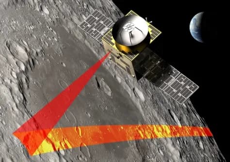
Moonraker月球LiDAR提案已獲選為歐洲下一代太空任務的研究候選項目之一,標誌著歐洲在月球測繪技術發展上邁出重要一步。
什麼是Moonraker?
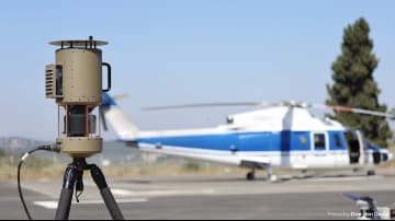
Moonraker是一項以LiDAR(光達,光學雷達測距)技術為核心的月球測繪任務提案,計畫透過高精度光達感測器對月球表面進行詳細的三維地形掃描與空間資料採集。這類技術在地球上已廣泛應用於無人機遙測、地形測量及基礎設施巡檢等領域,如今有望延伸至月球探勘任務。
LiDAR技術在太空探勘的潛力
LiDAR技術能夠以極高的精度測量距離與地形輪廓,即便在光線條件複雜的環境下亦能有效運作。應用於月球環境時,LiDAR可協助科學家與工程師:
- 建立高解析度月球地形圖
- 識別潛在的著陸點與資源分布區域
- 支援未來載人登月及月球基地選址規劃
歐洲太空任務的戰略意義
此次Moonraker獲選進入研究階段,反映出歐洲在國際月球探勘競賽中積極布局的戰略方向。隨著美國NASA的阿提米絲計畫(Artemis)及中國、日本等國家相繼推進月球任務,歐洲希望透過自主研發的先進測繪技術,在全球月球探勘合作中佔有一席之地。
目前Moonraker仍處於提案研究階段,後續將經過更詳細的可行性評估,才能確認是否正式納入歐洲太空總署(ESA)的任務規劃。
原文來源: 查看原文
常見問題
Newsletter
訂閱低空產業電子報
每日精選低空經濟與無人機產業新聞,直送您的信箱。
本文由 LAETimes 編輯部審核發佈 ·