Otago Regional Council Secures NZ$529,000 in Additional Funding for Region-Wide 3D LiDAR Mapping Project
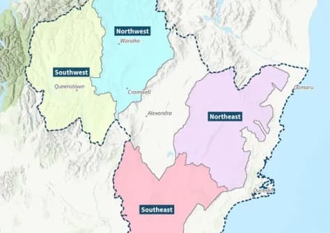
New Zealand's Otago Regional Council has approved NZ$529,000 in additional funding for its region-wide 3D LiDAR mapping programme, ensuring the project stays on track for completion in the 2027–28 financial year. The initiative will produce high-precision three-dimensional terrain data for use in environmental monitoring, flood risk assessment, land management, and regional planning across the Otago region.
Highlights
- The Otago Regional Council approved NZ$529,000 in additional funding for its region-wide 3D LiDAR mapping project.
- The project is scheduled for completion in the 2027–28 financial year and covers the entire Otago region of New Zealand.
- LiDAR data will be used for environmental monitoring, flood risk assessment, land management, and regional planning.
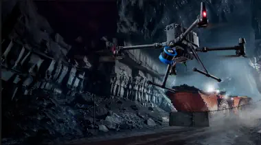
- LiDAR sensors mounted on drones or crewed aircraft can penetrate vegetation to deliver accurate ground-level elevation data.
- The completed 3D terrain database will serve as a core geospatial asset to support evidence-based decision-making by local government.
Otago Regional Council Secures Additional Funding for 3D LiDAR Mapping Programme
New Zealand's Otago Regional Council has announced NZ$529,000 in additional funding for its ongoing region-wide 3D LiDAR (Light Detection and Ranging) mapping project, keeping the programme on course for completion in the 2027–28 financial year.
Project Background
The 3D LiDAR programme covers the entire Otago region and uses LiDAR technology to conduct high-accuracy three-dimensional terrain scanning and modelling. The spatial datasets produced will be applied across a range of disciplines, including environmental monitoring, flood risk assessment, land management, and regional planning.
How the Funding Will Be Used
The NZ$529,000 top-up will cover additional costs incurred during project execution, ensuring that survey coverage meets the planned extent and that data quality standards are maintained throughout. Once complete, the comprehensive 3D terrain database will serve as a foundational geospatial asset for the Otago region.
Technical Value and Applications
LiDAR technology is commonly deployed via sensors mounted on drones or crewed aircraft to carry out large-scale terrain surveys. A key advantage of the technology is its ability to penetrate vegetation canopy and capture accurate ground-level elevation data — a capability that makes it indispensable in surveying, mapping, and environmental monitoring applications. The completion of Otago's 3D terrain dataset is expected to provide local government agencies with significantly more precise data to support evidence-based decision-making.
原文來源: 查看原文
FAQ
Newsletter
Subscribe to our Low-Altitude Industry Newsletter
Daily curated news on low-altitude economy and drone industry, delivered to your inbox.
Reviewed and published by the LAETimes editorial desk ·