來源:Robotics & Automation News
原文連結 RTK 資料覆蓋範圍解析:為何存取大量 RTK 基站至關重要
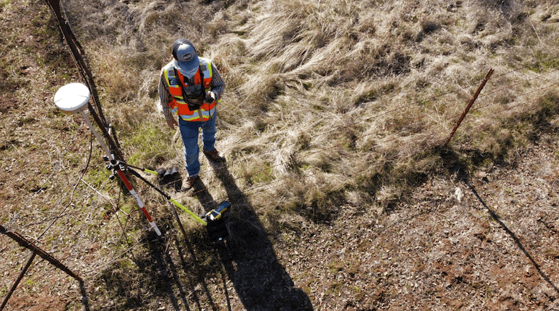
精準的田野定位不只仰賴優良的 GNSS 接收器,背後的差分修正網路同樣關鍵。基站距離、訊號品質、系統可用時間與區域覆蓋範圍,都會影響最終定位的穩定性。透過 RTKdata 等擁有大量基站資源的服務商,外業團隊能更有效維持高精度 RTK 定位表現。
LAETimes 編輯部AI 輔助編譯・經編輯部審核 ·
大約 1 個月前
1 / 15
+3
文章重點
- RTK 定位精度同時取決於 GNSS 接收器品質與背後差分修正網路的基站數量及覆蓋範圍。
- 基站距離縮短可減少大氣層與電離層誤差,使修正資料更準確,有效維持公分級定位精度。
- 採用 RTKdata 等擁有大規模基站網路的服務商,可在基站故障時無縫切換,降低作業中斷風險。
- 農業植保、測量測繪與無人機自動導航等應用場景,均需依賴穩定且廣覆蓋的 RTK 修正網路。
- 選擇 RTK 服務商時應評估基站密度、系統可用時間、區域覆蓋適配性及資料傳輸延遲等四大指標。
RTK 資料覆蓋範圍解析:為何存取大量 RTK 基站至關重要
精準的田野定位,不僅僅取決於一台優良的 GNSS 接收器。接收器背後所依賴的差分修正網路同樣至關重要——基站距離、訊號品質、系統正常運作時間(uptime)以及區域可用性,都直接影響最終定位結果的穩定性。
什麼是 RTK 差分修正網路?
RTK(Real-Time Kinematic,即時動態定位)技術透過地面參考基站,即時傳送差分修正資料給移動端接收器,將定位精度從公尺級大幅提升至公分級。然而,單一基站的覆蓋範圍有限,一旦作業區域超出有效距離,定位誤差便會明顯增大。
基站數量為何影響定位品質?
當外業團隊使用的 RTK 服務商擁有大量分布廣泛的基站網路時,有以下幾項關鍵優勢:
- 縮短基站距離:距離越近,大氣層延遲與電離層誤差越小,修正資料越準確。
- 提升訊號穩定性:密集的基站網路可在單一基站訊號中斷時,無縫切換至鄰近基站,維持連續作業。
- 強化區域覆蓋:偏遠地區、山區或農業腹地往往缺乏 RTK 基礎設施,廣布的網路可填補此類空白。
- 提高系統可用率:多基站備援架構能有效降低因單點故障導致的作業中斷風險。
RTKdata 的網路優勢
採用 RTKdata 等具備大規模基站存取能力的服務商,外業團隊能夠在更廣泛的地理範圍內持續獲得高品質的差分修正訊號。無論是農業植保、測量測繪,還是無人機自動導航等應用場景,穩定的 RTK 覆蓋都是確保作業精度與效率的基本前提。
實際應用的考量重點
在選擇 RTK 差分修正服務時,外業團隊應綜合評估以下條件:
- 基站密度:服務覆蓋區域內的基站分布是否足夠密集?
- 系統可用時間:服務商的基站網路是否具備高可靠性與低停機率?
- 區域適配性:所在作業區域是否在服務商的有效覆蓋範圍內?
- 資料傳輸延遲:修正資料的即時性是否符合作業需求?
精準定位是現代無人機作業、精準農業與地理測量的核心需求。選擇擁有龐大基站網路的 RTK 服務商,是確保公分級定位精度、降低外業風險的重要策略。
原文來源: 查看原文
常見問題
Newsletter
訂閱低空產業電子報
每日精選低空經濟與無人機產業新聞,直送您的信箱。
本文由 LAETimes 編輯部審核發佈 ·