YellowScan and DeltaQuad Launch Integrated LiDAR Mapping Solution Covering 1,200 Hectares Per Flight
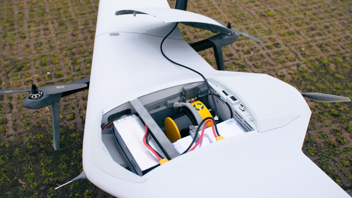
France-based YellowScan and Dutch drone manufacturer DeltaQuad have announced a strategic partnership integrating the Surveyor Ultra LiDAR system with the DeltaQuad Evo VTOL platform. The combined solution enables coverage of up to 1,200 hectares in a single flight while simultaneously collecting LiDAR and RGB imagery, significantly boosting efficiency for large-scale surveying projects across infrastructure, forestry, and environmental monitoring applications.

Highlights
- YellowScan and DeltaQuad announced a strategic partnership on October 7, 2024 to integrate the Surveyor Ultra LiDAR system with the DeltaQuad Evo VTOL drone platform.
- The combined solution covers up to 1,200 hectares in a single flight of approximately 2 hours and 30 minutes, significantly reducing project timelines and operational costs.
- The system simultaneously captures high-density LiDAR point clouds and RGB imagery, enabling production of DTMs and orthomosaics in one mission.
- The DeltaQuad Evo's long-range VTOL design allows deployment across large and complex terrain without requiring a traditional runway.
- Target applications include infrastructure surveying, forestry management, environmental monitoring, and architecture and engineering projects.
YellowScan and DeltaQuad Launch Integrated LiDAR Mapping Solution Covering 1,200 Hectares Per Flight
Montpellier, France — October 7, 2024 — YellowScan, a global leader in aerial LiDAR solutions, and DeltaQuad, a leading Dutch drone manufacturer, have announced a strategic partnership to integrate the Surveyor Ultra system with DeltaQuad's drone platform. The collaboration is expected to significantly advance the operational efficiency of drone-based LiDAR surveying, delivering unprecedented productivity gains for large-scale mapping projects.
Integrated Solution Dramatically Boosts Surveying Efficiency
The integration of the YellowScan Surveyor Ultra with the DeltaQuad Evo platform marks a new milestone in surveying operations. Users can now cover up to 1,200 hectares in a single flight, collecting high-accuracy, high-density data faster and more efficiently than ever before. With a built-in RGB camera, operators can simultaneously capture LiDAR and RGB imagery, completing larger survey areas in less time — reducing both project timelines and costs without compromising data quality.
Julien BO, Senior Business Development Manager for Europe at YellowScan, highlighted the value of the integration: "The combination of the YellowScan Surveyor Ultra and DeltaQuad's advanced Evo drone platform is designed to maximize efficiency in the field. Whether it's large infrastructure projects, forestry analysis, or environmental monitoring, users can now achieve faster, more detailed results. With a 2-hour 30-minute Evo flight mission, users can effortlessly produce georeferenced LiDAR point clouds, RGB-colored point clouds, Digital Terrain Models (DTMs), and, where needed, orthomosaics — an indispensable toolkit for boosting productivity."
DeltaQuad Evo's Long-Range VTOL Advantage
The DeltaQuad Evo features long-range flight capability and an efficient vertical take-off and landing (VTOL) design, making it well suited for surveying large and complex terrain. Paired with Surveyor Ultra's cutting-edge LiDAR technology — which generates dense point clouds even at higher flight altitudes — users can greatly streamline their workflows, significantly reducing both flight time and post-processing workload.
Benji Pauly, Solutions Specialist at DeltaQuad, underscored the partnership's significance for user efficiency: "Integrating YellowScan's Surveyor Ultra into our DeltaQuad Evo platform represents a major leap forward in aerial survey efficiency. By combining long-range flight capability with high-precision LiDAR, we've created a solution that enables professionals to achieve more with less effort. The core philosophy behind this collaboration is to help users work smarter, not harder."
Broad Application Potential
As market demand for rapid, reliable, and accurate geospatial data continues to grow, the YellowScan and DeltaQuad solution offers a comprehensive answer to improving operational efficiency and shortening project delivery timelines. This breakthrough integration is expected to benefit a wide range of industries, including surveying and mapping, architecture and engineering, forestry management, and environmental research.
About YellowScan
YellowScan is renowned for its high-performance aerial LiDAR solutions, offering fully integrated turnkey systems that simplify data acquisition workflows. Professionals worldwide rely on YellowScan's solutions to enhance productivity across surveying, forestry, and infrastructure development industries.
For more information, visit: www.yellowscan.com
About DeltaQuad
DeltaQuad is a leading provider of long-range VTOL drone technology, delivering advanced unmanned aerial solutions for surveying and surveillance missions. Its drone products are distinguished by exceptional range, reliability, and ease of use, helping users maximize productivity across a broad range of professional applications.
For more information, visit: www.deltaquad.com
Media Contact: Morgane Selve — Head of Marketing & Communications, YellowScan press@yellowscan.com
原文來源: 查看原文
FAQ
Newsletter
Subscribe to our Low-Altitude Industry Newsletter
Daily curated news on low-altitude economy and drone industry, delivered to your inbox.
Reviewed and published by the LAETimes editorial desk ·