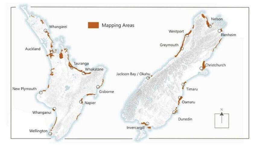
New Zealand Launches National Coastal LiDAR Dataset Initiative
New Zealand has officially launched a national coastal LiDAR dataset programme to address longstanding challenges in accurately collecting geospatial data along its coastlines. The initiative uses advanced airborne LiDAR technology to build a unified, high-precision geospatial foundation for the country's entire coastline, supporting coastal erosion monitoring, tsunami risk assessment, infrastructure planning, and environmental management.

Highlights
- New Zealand has officially launched a national coastal LiDAR dataset programme to create unified, high-precision geospatial data for the country's entire coastline.
- Airborne LiDAR systems — mountable on manned aircraft or large drones — generate dense 3D point clouds and are particularly effective in coastal dunes, mangroves, and intertidal zones.
- The dataset will directly support tsunami inundation modelling, sea-level rise scenario planning, coastal erosion time-series analysis, and infrastructure development.
- Open sharing of the dataset will allow government agencies, academic institutions, and private enterprises to collaborate under a unified data standard, eliminating duplicate survey efforts.
- The initiative positions New Zealand as a reference model for national-scale coastal mapping as climate change intensifies coastal risks globally.
The Challenge of Coastal Geospatial Data
Despite rapid advances in geospatial technology over the past two decades, coastal zones remain among the most difficult environments for data collection. Coastal terrain changes too quickly for static surveys to keep pace; water depths are too shallow for deep-water acoustic systems to operate effectively; and the sheer scale of coastlines makes comprehensive ground-based measurement impractical.
New Zealand's Geographic Context
As an island nation with an extensive coastline, New Zealand relies heavily on accurate coastal geospatial data for a wide range of critical applications — including coastal erosion monitoring, tsunami risk assessment, infrastructure planning, and environmental resource management. The long-standing absence of a unified, high-quality national coastal dataset has constrained the precision of decision-making by government agencies and research institutions alike.
The Role of LiDAR Technology
LiDAR (Light Detection and Ranging) works by firing laser pulses at the ground and recording the time taken for reflections to return, rapidly generating dense, highly accurate three-dimensional point cloud data. Compared with conventional aerial photogrammetry, LiDAR offers clear advantages in vegetated areas and complex terrain — making it particularly well-suited for mapping coastal dunes, mangroves, and intertidal zones.
Airborne LiDAR systems can be mounted on manned aircraft or large-format drones to conduct systematic coastal surveys, significantly improving data acquisition efficiency. New Zealand's national coastal LiDAR dataset programme combines aerial remote sensing with advanced data processing techniques to establish a sustainable, updatable coastal geospatial database.
Significance and Applications
The establishment of a national coastal LiDAR dataset is expected to have far-reaching impact across the following areas:
- Coastal Erosion and Change Monitoring: Repeated periodic scans enable time-series tracking of shoreline change.
- Climate Change Adaptation Planning: High-precision terrain data underpins sea-level rise scenario modelling.
- Disaster Preparedness and Emergency Response: Enhances the accuracy of tsunami inundation modelling and storm surge forecasting.
- Ecosystem Management: Supports assessment of the health of coastal wetlands, dunes, coral reefs, and other habitats.
- Infrastructure and Land Development: Provides reliable topographic references for ports, roads, and coastal construction projects.
The open sharing of this dataset will also enable academic institutions, local government bodies, and private enterprises to collaborate across sectors using a common data standard — eliminating duplicated data collection efforts and reducing resource waste.
Conclusion
New Zealand's national coastal LiDAR dataset initiative marks a significant step forward in the country's national geospatial infrastructure. As climate change intensifies coastal risks, high-precision, systematic coastal data of this kind is becoming an indispensable decision-making tool for governments worldwide — and New Zealand's programme sets a compelling precedent for global coastal mapping efforts.
原文來源: 查看原文
FAQ
Newsletter
Subscribe to our Low-Altitude Industry Newsletter
Daily curated news on low-altitude economy and drone industry, delivered to your inbox.


