Latest
New Zealand Launches National Coastal LiDAR Dataset Initiative
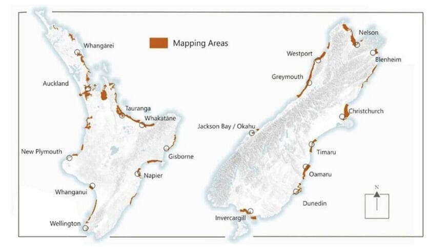
New Zealand has officially launched a national coastal LiDAR dataset programme to address longstanding challenges in accurately collecting geospatial data along its coastlines. The initiative uses advanced airborne LiDAR technology to build a unified, high-precision geospatial foundation for the country's entire coastline, supporting coastal erosion monitoring, tsunami risk assessment, infrastructure planning, and environmental management.
測量測繪環境監測
6 days agoSource: LiDAR News